
IMAGES TAKEN NEAR TO
Main Road, HOPE VALLEY, S32 1BB
Introduction
This page details the photographs taken nearby to Main Road, S32 1BB by members of the Geograph project.
The Geograph project started in 2005 with the aim of publishing, organising and preserving representative images for every square kilometre of Great Britain, Ireland and the Isle of Man.

There are currently over 7.5m images from over14,400 individuals and you can help contribute to the project by visiting https://www.geograph.org.uk
Image Map
Images are licensed for reuse under creativecommons.org/licenses/by-sa/2.0
Notes
- Clicking on the map will re-center to the selected point.
- The higher the marker number, the further away the image location is from the centre of the postcode.
Image Listing (250 Images Found)
Images are licensed for reuse under creativecommons.org/licenses/by-sa/2.0
Image
Details
Distance
1
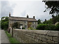
Hall Farmhouse, Baulk Lane
Dates from the late eighteenth century, http://www.britishlistedbuildings.co.uk/101109796-hall-farmhouse-boundary-wall-and-gate-piers-hathersage#.WS3YL8a1s1k
Image: © Jonathan Thacker
Taken: 19 May 2017
0.02 miles
2
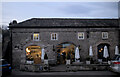
Delicatessen
In what appear to have once been stables, or a shambles, is a very expensive modern delicatessen in The Square.
Image: © Bob Harvey
Taken: 15 Feb 2023
0.02 miles
3
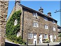
Bank Cottages
Formerly a workshop, now three cottages. Built in 1781, the cottages are listed, grade II, with details at: https://www.historicengland.org.uk/listing/the-list/list-entry/1158559
Image: © Michael Dibb
Taken: 29 Jun 2018
0.03 miles
4
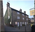
The 1781 cottages, Besom Lane
Now known as Bank Cottages because a 19th century bank was built in front of them, these are listed by Historic England as "The 1781 cottages" (https://historicengland.org.uk/listing/the-list/list-entry/1158559?section=official-list-entry ). The listing says "Former workshop, now a row of cottages. Dated 1781". There is a little more detail in the Derbyshire Historic Environment Record (https://her.derbyshire.gov.uk/Monument/MDR6641 ), which says it was used as a button factory.
You will notice that windows have, at some time, been removed from the upper stories of number 1. There is a circular plaque, which superficially appears blank, but is the datestone referred to in the Derbyshire record. See Image
Image: © Bob Harvey
Taken: 15 Feb 2023
0.03 miles
5

Modern retail banners
These vertical banners are a feature of modern retailing and exhibitions. This is the entrance to the Alpkit store. Note the cycle on the wall. Cycles feature in the retailer's kit.
Image: © Bob Harvey
Taken: 15 Feb 2023
0.03 miles
6
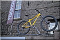
Yellow Bike
We are used to yellow bikes, often associated with cycle race routes. Normally they are some unrecoverable wreck of a machine, painted all over with yellow household paint. This one is different, a fully functional modern mountain bike.
Image: © Bob Harvey
Taken: 15 Feb 2023
0.03 miles
7
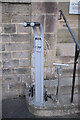
Public cycle repair stand
I had not come across this sort of thing before, and assumed it was erected by the philanthropy of the adjacent Alpkit store. A few days later I saw one discretely hidden on Crewe Station, so it seems they are more common that I suspected.
And, indeed, a fellow Geographist has already captured one: Image
See also Image
Image: © Bob Harvey
Taken: 15 Feb 2023
0.03 miles
8
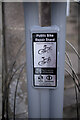
Label on cycle repair stand
See Image for context.
Image: © Bob Harvey
Taken: 15 Feb 2023
0.03 miles
9
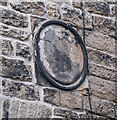
Datestone
The datestone on Image, inscribed as described in the Derbyshire Historic Environment Record (https://her.derbyshire.gov.uk/Monument/MDR6641 ), "T F A 1781" (although I might have written that as "F T A 1781").
Image: © Bob Harvey
Taken: 15 Feb 2023
0.03 miles
10
Outdoor store, Hathersage
One of at least three outdoor shops in the Peak District village of Hathersage. This one is also known as the "Square Shop". Seen from the footpath to Oddfellows Road.
Image: © Andrew Hill
Taken: 14 Sep 2012
0.03 miles