
IMAGES TAKEN NEAR TO
The Dale, HOPE VALLEY, S32 1AQ
Introduction
This page details the photographs taken nearby to The Dale, S32 1AQ by members of the Geograph project.
The Geograph project started in 2005 with the aim of publishing, organising and preserving representative images for every square kilometre of Great Britain, Ireland and the Isle of Man.

There are currently over 7.5m images from over14,400 individuals and you can help contribute to the project by visiting https://www.geograph.org.uk
Image Map
Images are licensed for reuse under creativecommons.org/licenses/by-sa/2.0
Notes
- Clicking on the map will re-center to the selected point.
- The higher the marker number, the further away the image location is from the centre of the postcode.
Image Listing (142 Images Found)
Images are licensed for reuse under creativecommons.org/licenses/by-sa/2.0
Image
Details
Distance
1
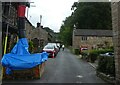
Construction on The Dale
Looking along The Dale in Hathersage.
Image: © DS Pugh
Taken: 29 Aug 2022
0.02 miles
2
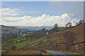
The Last Mile
Heading down The Dale into Hathersage after hiking from Sheffield
Image: © Pezter
Taken: 8 Mar 2009
0.03 miles
3
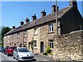
Eastwood Cottages
This mid 18th century terrace of seven houses was once connected with Dale Mill opposite. The far end two are listed, grade II, with details at: https://www.historicengland.org.uk/listing/the-list/list-entry/1311435
Image: © Michael Dibb
Taken: 29 Jun 2018
0.04 miles
4
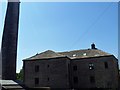
Dale Mill
This former wire-drawing mill is now apartments. Built in the early 19th century, the mill and the detached chimney are listed, grade II, with details at: https://www.historicengland.org.uk/listing/the-list/list-entry/1109798
Image: © Michael Dibb
Taken: 29 Jun 2018
0.04 miles
5
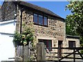
The Cottage
An attractive cottage in the delightfully named Hungry Lane.
Image: © Michael Dibb
Taken: 29 Jun 2018
0.08 miles
6
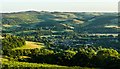
Overlooking Hathersage
Nestling in the Derwent Valley below Eyam Moor
Image: © Graham Hogg
Taken: 21 Jun 2018
0.08 miles
8
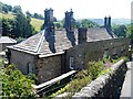
Rock House
This somewhat unusual house was built circa 1830. Listed, grade II, with details at: https://www.historicengland.org.uk/listing/the-list/list-entry/1109808
Image: © Michael Dibb
Taken: 29 Jun 2018
0.09 miles
9
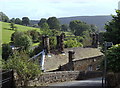
A corner of Hathersage near the church
The church is high on the hillside and the nearby houses and cottages are in a lovely setting.
Image: © Andrew Hill
Taken: 14 Sep 2012
0.09 miles
10
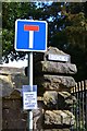
Sat-Nav Error
The message reads: "SAT-NAV ERROR NO ACCESS TO NORTH LEES CAMPSITE". Now at this point a true geographer should not be blindly following their sat-nav...
Image: © David Martin
Taken: 21 Feb 2015
0.09 miles