
IMAGES TAKEN NEAR TO
Kiveton Lane, SHEFFIELD, S26 6NL
Introduction
This page details the photographs taken nearby to Kiveton Lane, S26 6NL by members of the Geograph project.
The Geograph project started in 2005 with the aim of publishing, organising and preserving representative images for every square kilometre of Great Britain, Ireland and the Isle of Man.

There are currently over 7.5m images from over14,400 individuals and you can help contribute to the project by visiting https://www.geograph.org.uk
Image Map
Images are licensed for reuse under creativecommons.org/licenses/by-sa/2.0
Notes
- Clicking on the map will re-center to the selected point.
- The higher the marker number, the further away the image location is from the centre of the postcode.
Image Listing (21 Images Found)
Images are licensed for reuse under creativecommons.org/licenses/by-sa/2.0
Image
Details
Distance
5
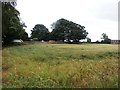
Garden Wall at Kiveton Hall Farm
Part of this wall survived the demolition of Kiveton Hall and is Grade II listed.
Image: © Jonathan Clitheroe
Taken: 16 Jul 2016
0.09 miles
6

Kiveton Hall
The present Kiveton Hall occupies part of the site of the former Keeton Hall, seat of the Osborne family, Dukes of Leeds. The original (Keeton) Hall, a much grander property, was built around 1698 by Thomas Osborne, the First Duke of Leeds to replace the Elizabethan Thorpe Hall at nearby Thorpe Salvin, but was subsequently demolished by the 6th Duke in 1811 who then relocated to Hornby Castle in North Yorkshire. It is known that in 1806 the estate was visited by the then Prince of Wales, who was later to become King George IV. Local legend has it that a wager between the Duke and the future King led to the demolition of the Hall, but this story has little foundation.
The former Duke’s estate, covering an area of 600 acres, was used for hunting by the Duke and his guests and is the very reason why the village of Kiveton was later renamed Kiveton Park (indeed, the old definition of 'Park; is "an enclosed area of land stocked with game and held by royal prescription"). The Duke’s hunting hounds were housed in kennels near where Kiveton Park Station stands today and that part of the village became known locally as “Dog Kennels”, although nowadays is generally referred to as Kiveton Park Station, distinguishing it from the main bulk of the village approximately one mile to the west.
Image: © Mike Nield
Taken: 21 Jun 2013
0.13 miles
7
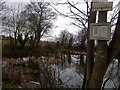
Junction Fishing Club Pond
Barbless hooks only, no open feeders, no groundbait, no boilies, no braid, no keepnets, no cat or dog food, no night fishing, dawn to dusk only. Day tickets available. Adults £3, Under-15's & OAPs £3. After 4pm £2.
Image: © Karl Smt
Taken: 9 Feb 2013
0.13 miles
8
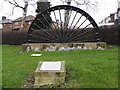
Winding Wheel
Wales Parish Council commemoration of the Mining Industry in Wales and Kiveton Park.
Image: © Alan Heardman
Taken: 27 Jan 2009
0.14 miles
10
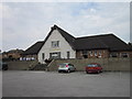
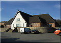
The Saxon Hotel, Kiveton Park
A Sam Smith's public house.
Image: © Ian S
Taken: 12 Aug 2012
0.15 miles