IMAGES TAKEN NEAR TO
Christchurch Avenue, SHEFFIELD, S26 2AW

Introduction

This page details the photographs taken nearby to Christchurch Avenue, S26 2AW by members of the Geograph project.

The Geograph project started in 2005 with the aim of publishing, organising and preserving representative images for every square kilometre of Great Britain, Ireland and the Isle of Man.

There are currently over 7.5m images from over14,400 individuals and you can help contribute to the project by visiting https://www.geograph.org.uk

Image Map


Images are licensed for reuse under creativecommons.org/licenses/by-sa/2.0
Notes
  • Clicking on the map will re-center to the selected point.
  • The higher the marker number, the further away the image location is from the centre of the postcode.

Image Listing (13 Images Found)

Images are licensed for reuse under creativecommons.org/licenses/by-sa/2.0
Image
Details
Distance
1
Worksop Road, Aston
Image: © JThomas Taken: 27 Aug 2011
0.07 miles
2
Service Station on Worksop Road
Image: © JThomas Taken: 27 Aug 2011
0.07 miles
3
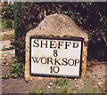
Old Milestone, on Worksop Rd (was A57), Aston
Opposite Lodge Lane. Located on the North side of road, on verge at side drive to No. 145. Stone post (plate now lost), 18th century. 2005 view see http://www.geograph.org.uk/photo/6742806 Inscription reads: (SHEFFᴰ / 8 / WORKSOP / 10) Grade II listed by Historic England. see https://historicengland.org.uk/listing/the-list/list-entry/1151883 Milestone Society National ID: YS_SFWS08
Image: © Christine Minto Taken: Unknown
0.11 miles
4
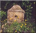
Old Milestone, on Worksop Rd (was A57), Aston (2005)
Opposite Lodge Lane. Located on the North side of road, on verge at side drive to No. 145. Stone post (plate lost), 18th century. Pre 2005 view see http://www.geograph.org.uk/photo/6742793 Inscription reads: (SHEFFᴰ / 8 / WORKSOP / 10) Grade II listed by Historic England. see https://historicengland.org.uk/listing/the-list/list-entry/1151883 Milestone Society National ID: YS_SFWS08
Image: © Christine Minto Taken: Unknown
0.11 miles
5
Old milestone
Worksop Road in Aston was the original main route to and from Sheffield. This milestone opposite Lodge Lane is one of four stones remaining from the era of the 16 mile long Worksop to Attercliffe (Sheffield) tollroad, 1764-1881. The plate has disappeared since 1992 when it was first photographed but a feature is made of the stone now with the pebble surround. It is Grade II listed, 1151883. Link Image for Sheffield 9 which does have its plate.
Image: © Chris Minto Taken: 22 Aug 2021
0.11 miles
6
Ulley Lane at Aughton Lane
Image: © Ian S Taken: 18 Mar 2012
0.14 miles
7
Shopping Centre in Aston
Image: © Chris Taken: 9 Sep 2016
0.14 miles
8
William Layne Reading Room, Aston
The Parish Council’s Grade II listed building is known as the William Layne Reading Room in memory of the late Parish and Rotherham Borough Councillor. It is recorded that the building opened as a school in 1743, and that the first teacher at the school was Samuel Craven who was paid a half-yearly salary of £4. The Reading Room continued as a school until 1890. Reading RoomIn the 270 plus years since it was built, what had become known as the ‘Reading Room’ on Aughton Lane, had been the first original school, community centre, storeroom and workshop and had lain empty and suffered years of neglect. But thanks to a £178,500 grant from the Heritage Lottery Fund (HLF) this historic building was restored and once again put to good use for the benefit of the local community. See http://www.aston-cum-aughton-pc.gov.uk/aston-cum-aughton/william_layne_reading_room-14915.aspx
Image: © Chris Taken: 9 Sep 2016
0.16 miles
9
William Lane reading room
By the road junction of the B6067 and opposite a parade of shops.
Image: © roger geach Taken: 22 Jun 2010
0.17 miles
10
Road Junction on the B6067 Aston
Image: © roger geach Taken: 22 Jun 2010
0.17 miles