
IMAGES TAKEN NEAR TO
City Road, SHEFFIELD, S2 5HH
Introduction
This page details the photographs taken nearby to City Road, S2 5HH by members of the Geograph project.
The Geograph project started in 2005 with the aim of publishing, organising and preserving representative images for every square kilometre of Great Britain, Ireland and the Isle of Man.

There are currently over 7.5m images from over14,400 individuals and you can help contribute to the project by visiting https://www.geograph.org.uk
Image Map
Images are licensed for reuse under creativecommons.org/licenses/by-sa/2.0
Notes
- Clicking on the map will re-center to the selected point.
- The higher the marker number, the further away the image location is from the centre of the postcode.
Image Listing (34 Images Found)
Images are licensed for reuse under creativecommons.org/licenses/by-sa/2.0
Image
Details
Distance
1
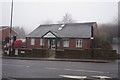
Castle Dental Practice on City Road, Sheffield
Image: © Ian S
Taken: 18 Dec 2019
0.08 miles
2
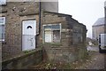
Former H W Roberts Memorial Works
On City Road, Sheffield.
Image: © Ian S
Taken: 18 Dec 2019
0.10 miles
3

Junior school to restaurant
Change in use at former school on City Road, Manor Lane; Kebabish grill bar restaurant.
Image: © Peter Barr
Taken: 19 Jul 2011
0.10 miles
4
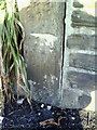
Benchmark on gatepost between #261 and #263 City Road
Ordnance Survey cut mark benchmark described on the Bench Mark Database at http://www.bench-marks.org.uk/bm36674
Image: © Roger Templeman
Taken: 1 Feb 2011
0.10 miles
5
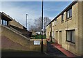
Plover Court, Skye Edge
Social housing in an area of Sheffield known as Sheffield Park. It was once a hunting ground connected with nearby Sheffield Manor where Mary Queen of Scots was imprisoned for fourteen years.
Image: © Neil Theasby
Taken: 18 Feb 2020
0.11 miles

8
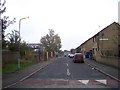
Skye Edge Avenue at Sky Edge
For some reason all of the maps and street guides use different spellings for the street names and the area. On the left you can see the building site for the new health centre, on the right is local authority built housing.
Image: © Martin Speck
Taken: 10 Oct 2007
0.13 miles
9
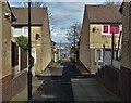
Social housing on Skye Edge, Sheffield 2
To the left there's Quail Rise and on the right Plover Court. All the streets and closes off Skye Edge Avenue are named after British birds.
Image: © Neil Theasby
Taken: 18 Feb 2020
0.13 miles
