IMAGES TAKEN NEAR TO
Sikes Road, SHEFFIELD, S25 4DX
Introduction
This page details the photographs taken nearby to Sikes Road, S25 4DX by members of the Geograph project.
The Geograph project started in 2005 with the aim of publishing, organising and preserving representative images for every square kilometre of Great Britain, Ireland and the Isle of Man.

There are currently over 7.5m images from over14,400 individuals and you can help contribute to the project by visiting https://www.geograph.org.uk
Image Map (Loading...)


Getting Data...Please wait
Leaflet Map data © OpenStreetMap
Images are licensed for reuse under creativecommons.org/licenses/by-sa/2.0
Notes
- Clicking on the map will re-center to the selected point.
- The higher the marker number, the further away the image location is from the centre of the postcode.
Image Listing (15 Images Found)
Images are licensed for reuse under creativecommons.org/licenses/by-sa/2.0
Image
Details
Distance
1
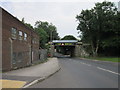
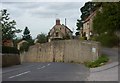
Ryton Road, North Anston
Ryton Road is the B6060 from Dinnington through North Anston towards the A57.
Image: © Andrew Hill
Taken: 4 Sep 2010
0.06 miles
2
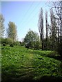
Brook Walk, Anston
This recreation area was created in the 1990's on a site occupied by a former sewage works. Once the heavy engineering work had been done to remove the machinery from the site, much of the restoration was undertaken by adult volunteers and junior school children from Anston Brook School.
The site was sold by Severn Trent Water to Anston Parish Council for one pound [£1.00 GBP]
Image: © Robin Stonebridge
Taken: 15 Apr 2007
0.09 miles
3
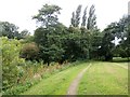
Brook Walk in Anston
This attractive area incorporated both a sewage works and a tip before being restored with the help of local volunteers and officially re-opened in 1994. This view is looking in the direction of Anston Bridge.
Image: © Jonathan Clitheroe
Taken: 15 Jul 2016
0.13 miles
4
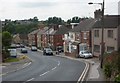
Main Street, North Anston
This is now a relatively quiet street with the main axis now being north/south.
Image: © Andrew Hill
Taken: 4 Sep 2010
0.13 miles
5
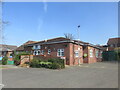
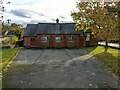
The parish hall in North Anston.
Good starting point for a walk.
Image: © steven ruffles
Taken: 17 Apr 2021
0.13 miles
6
North Anston Methodist Church viewed from Chapel Rise. Houses on The Wells in the background
Image: © Tom Page
Taken: 29 Oct 2021
0.13 miles
7
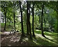
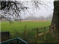
Brook Walk
North Anston, South Yorkshire.
Image: © Mike Nield
Taken: 2 Sep 2013
0.14 miles
9
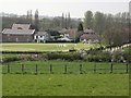
Anston Cricket field
This cricket field isn't 'near to Anston' it is in the village itself.
Image: © Robin Stonebridge
Taken: 15 Apr 2007
0.19 miles