IMAGES TAKEN NEAR TO
Cherry Street, SHEFFIELD, S2 4ST
Introduction
This page details the photographs taken nearby to Cherry Street, S2 4ST by members of the Geograph project.
The Geograph project started in 2005 with the aim of publishing, organising and preserving representative images for every square kilometre of Great Britain, Ireland and the Isle of Man.

There are currently over 7.5m images from over14,400 individuals and you can help contribute to the project by visiting https://www.geograph.org.uk
Image Map (Loading...)


Getting Data...Please wait
Leaflet Map data © OpenStreetMap
Images are licensed for reuse under creativecommons.org/licenses/by-sa/2.0
Notes
- Clicking on the map will re-center to the selected point.
- The higher the marker number, the further away the image location is from the centre of the postcode.
Image Listing (180 Images Found)
Images are licensed for reuse under creativecommons.org/licenses/by-sa/2.0
Image
Details
Distance
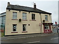
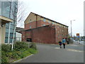
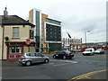
1
Looking from Bramall Lane into Cherry Street
Image: © Basher Eyre
Taken: 3 Apr 2012
0.04 miles
2
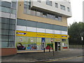
Bramall Lane Convenience Store
A 'Premier' store at the junction of Bramall Lane and Cherry Street.
Image: © M J Richardson
Taken: 11 Oct 2011
0.05 miles
4
Passing the Arnold Laver Group in Bramall Lane
Image: © Basher Eyre
Taken: 3 Apr 2012
0.06 miles
5
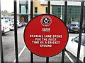
Bramall Lane Cricket Ground
Plaque recording the origin of the Sheffield United FC at Bramall Lane as a cricket ground in 1855.
Image: © M J Richardson
Taken: 11 Oct 2011
0.06 miles
6

Junction of Bramall Lane and Cherry Street
Image: © Basher Eyre
Taken: 3 Apr 2012
0.06 miles
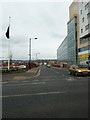
7
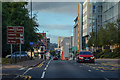
Sheffield : Bramall Lane A621
Heading along Bramall Lane in Sheffield.
Image: © Lewis Clarke
Taken: 30 Sep 2018
0.06 miles
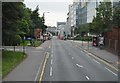
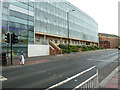
9
Crossroads of Bramall Lane, Hill Street and Cherry Street
Image: © Basher Eyre
Taken: 3 Apr 2012
0.07 miles