
IMAGES TAKEN NEAR TO
Shrewsbury Road, SHEFFIELD, S2 2TN
Introduction
This page details the photographs taken nearby to Shrewsbury Road, S2 2TN by members of the Geograph project.
The Geograph project started in 2005 with the aim of publishing, organising and preserving representative images for every square kilometre of Great Britain, Ireland and the Isle of Man.

There are currently over 7.5m images from over14,400 individuals and you can help contribute to the project by visiting https://www.geograph.org.uk
Image Map
Images are licensed for reuse under creativecommons.org/licenses/by-sa/2.0
Notes
- Clicking on the map will re-center to the selected point.
- The higher the marker number, the further away the image location is from the centre of the postcode.
Image Listing (687 Images Found)
Images are licensed for reuse under creativecommons.org/licenses/by-sa/2.0
Image
Details
Distance
1

Claywood Road
Claywood Road is an exceptionally short street, consisting of just the houses to the right of the street sign, the others being in Shrewsbury Road.
Image: © Anne Burgess
Taken: 5 Apr 2012
0.01 miles
2
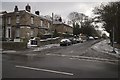
Norfolk Road junction with Talbot Street
Image: © Mark Anderson
Taken: 19 Mar 2018
0.02 miles
3
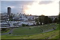
Southeast View of the City of Sheffield
View of Sheffield city centre on a summer evening from Park Hill to the south east of the city centre.
Image: © Andrew Tryon
Taken: 27 Jun 2016
0.03 miles
5

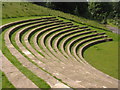
Amphitheatre in the Park
An open air performance area in South Street Park, a stone's throw from the main railway station.
Image: © Anne Burgess
Taken: 5 Apr 2012
0.04 miles
6
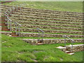
South Street Park
The amphitheatre, part of the new £800,000 South Street Park, which lies behind the Sheffield railway station.
Image: © Dave Pickersgill
Taken: 18 May 2012
0.05 miles
7
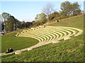
South Street Park Theatre
The new open-air theatre in South Street Park.
Image: © Martin Speck
Taken: 16 Oct 2011
0.05 miles
8
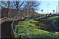
Steps up from Sheffield Station to Park Hill flats
Image: © David Martin
Taken: 16 Feb 2016
0.05 miles
9
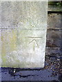
Benchmark on Almshouses gatepost, Norfolk Road
Ordnance Survey cut mark benchmark described on the Bench Mark Database at http://www.bench-marks.org.uk/bm36654
Image: © Roger Templeman
Taken: 1 Feb 2011
0.05 miles
10
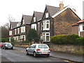
Substantial Victorian houses in Norfolk Road
Image: © Rod Allday
Taken: 4 Apr 2012
0.06 miles