IMAGES TAKEN NEAR TO
Rotherside Road, SHEFFIELD, S21 4LN
Introduction
This page details the photographs taken nearby to Rotherside Road, S21 4LN by members of the Geograph project.
The Geograph project started in 2005 with the aim of publishing, organising and preserving representative images for every square kilometre of Great Britain, Ireland and the Isle of Man.

There are currently over 7.5m images from over14,400 individuals and you can help contribute to the project by visiting https://www.geograph.org.uk
Image Map
Images are licensed for reuse under creativecommons.org/licenses/by-sa/2.0
Notes
- Clicking on the map will re-center to the selected point.
- The higher the marker number, the further away the image location is from the centre of the postcode.
Image Listing (14 Images Found)
Images are licensed for reuse under creativecommons.org/licenses/by-sa/2.0
Image
Details
Distance
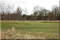
2
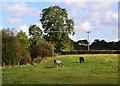
Horse pasture east of Eckington
East of the River Rother
Image: © Neil Theasby
Taken: 4 Oct 2012
0.14 miles
3
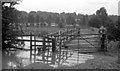
Bridges across the River Rother
The river was in flood and just below the large bridge to the right and just above the new footbridge to the left. The normal level of the river was several feet below the bridges. On reflection, it was possibly quite dangerous for me to have crossed the river in flood that day! The large bridge was little more than 2 RSJs with railway sleepers in between; at a very early age I was taught to step on the cracks so that I was always on 2 pieces of wood at once, just in case! By the time this photograph was taken the large bridge had lost some of the sleepers which were beginning to rot and it was too dangerous to use. A new footbridge was installed next to it using what I think was a reinforced concrete beam about 9 inches wide. It was too narrow to push a bicycle across and there wasn't room to turn the pedals because of the rails being too close together. One sat on the bicycle and pulled oneself across with one hand using the rails which were splayed outwards. The other hand was for steering as the bridge was so narrow!
See Image for a more up to date view.
Image: © Andrew Tatlow
Taken: Unknown
0.15 miles
4
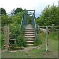
Footbridge over the River Rother
Footpath towards Eckington from Killamarsh.
Image: © Andrew Hill
Taken: 17 Jun 2011
0.15 miles
5

View from Bridge CHR/115
Near Eckington, on a path towards Westhorpe, looking back to Eckington.
Image: © Peter Barr
Taken: 11 Jul 2012
0.18 miles
7
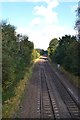
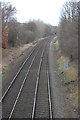
Railway track to Rotherham
Seen from a railway bridge east of Eckington
Image: © Neil Theasby
Taken: 4 Oct 2012
0.18 miles