IMAGES TAKEN NEAR TO
Fern Way, SHEFFIELD, S21 4HF
Introduction
This page details the photographs taken nearby to Fern Way, S21 4HF by members of the Geograph project.
The Geograph project started in 2005 with the aim of publishing, organising and preserving representative images for every square kilometre of Great Britain, Ireland and the Isle of Man.

There are currently over 7.5m images from over14,400 individuals and you can help contribute to the project by visiting https://www.geograph.org.uk
Image Map (Loading...)


Getting Data...Please wait
Leaflet Map data © OpenStreetMap
Images are licensed for reuse under creativecommons.org/licenses/by-sa/2.0
Notes
- Clicking on the map will re-center to the selected point.
- The higher the marker number, the further away the image location is from the centre of the postcode.
Image Listing (5 Images Found)
Images are licensed for reuse under creativecommons.org/licenses/by-sa/2.0
Image
Details
Distance
1
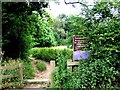
Eckington Woods (from top end of Back Lane)
Image: © Andrew Loughran
Taken: 8 Jul 2006
0.07 miles
2
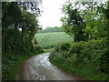
Track corner, Back Lane, Eckington
The track leaving the northwestern tip of the housing estate in Eckington.
Image: © Andrew Hill
Taken: 30 May 2011
0.10 miles
4
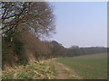
Well used informal path along High Bramley Wood
Image: © John Slater
Taken: 10 Apr 2013
0.22 miles
5
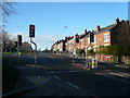
Eckington - Chesterfield Road Junction with Dronfield Road (B6056)
Image: © Alan Heardman
Taken: 11 Dec 2007
0.23 miles