IMAGES TAKEN NEAR TO
Sherwood Road, SHEFFIELD, S21 2EG
Introduction
This page details the photographs taken nearby to Sherwood Road, S21 2EG by members of the Geograph project.
The Geograph project started in 2005 with the aim of publishing, organising and preserving representative images for every square kilometre of Great Britain, Ireland and the Isle of Man.

There are currently over 7.5m images from over14,400 individuals and you can help contribute to the project by visiting https://www.geograph.org.uk
Image Map
Images are licensed for reuse under creativecommons.org/licenses/by-sa/2.0
Notes
- Clicking on the map will re-center to the selected point.
- The higher the marker number, the further away the image location is from the centre of the postcode.
Image Listing (21 Images Found)
Images are licensed for reuse under creativecommons.org/licenses/by-sa/2.0
Image
Details
Distance
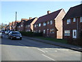
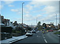
1
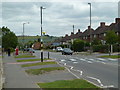
Rotherham Road, Killamarsh
The top of the road, looking away from the junction. This is the A618.
Image: © Andrew Hill
Taken: 17 Jun 2011
0.11 miles
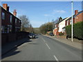
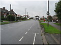
3
Sheffield Road (B6058)
Heading south east towards the A618.
Image: © JThomas
Taken: 7 Mar 2015
0.13 miles
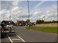
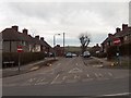
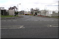
8
Mansfield Road/Sheffield Road/Rotherham Road junction
Image: © Colin Pyle
Taken: 2 Feb 2019
0.14 miles
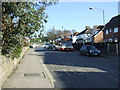
9
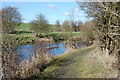
Norwood Industrial Estate
Norwood Industrial Estate is built either side of the now disused section of the Chesterfield Canal.
Image: © Michael Patterson
Taken: 14 Feb 2006
0.16 miles