IMAGES TAKEN NEAR TO
Rectory Road, SHEFFIELD, S21 1DQ
Introduction
This page details the photographs taken nearby to Rectory Road, S21 1DQ by members of the Geograph project.
The Geograph project started in 2005 with the aim of publishing, organising and preserving representative images for every square kilometre of Great Britain, Ireland and the Isle of Man.

There are currently over 7.5m images from over14,400 individuals and you can help contribute to the project by visiting https://www.geograph.org.uk
Image Map
Images are licensed for reuse under creativecommons.org/licenses/by-sa/2.0
Notes
- Clicking on the map will re-center to the selected point.
- The higher the marker number, the further away the image location is from the centre of the postcode.
Image Listing (84 Images Found)
Images are licensed for reuse under creativecommons.org/licenses/by-sa/2.0
Image
Details
Distance
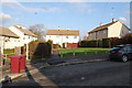
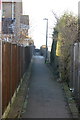
4

Path Rectory Road to Norburn Drive
Shortcut between streets, also known as :- snickets or ginnels
Image: © John Jennings
Taken: 3 Feb 2012
0.06 miles
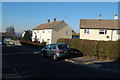
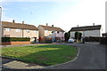
7
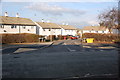
Junction Ashley Close & Norburn Drive
Image: © John Jennings
Taken: 30 Jan 2012
0.07 miles