
IMAGES TAKEN NEAR TO
Newbould Crescent, SHEFFIELD, S20 1FF
Introduction
This page details the photographs taken nearby to Newbould Crescent, S20 1FF by members of the Geograph project.
The Geograph project started in 2005 with the aim of publishing, organising and preserving representative images for every square kilometre of Great Britain, Ireland and the Isle of Man.

There are currently over 7.5m images from over14,400 individuals and you can help contribute to the project by visiting https://www.geograph.org.uk
Image Map
Images are licensed for reuse under creativecommons.org/licenses/by-sa/2.0
Notes
- Clicking on the map will re-center to the selected point.
- The higher the marker number, the further away the image location is from the centre of the postcode.
Image Listing (23 Images Found)
Images are licensed for reuse under creativecommons.org/licenses/by-sa/2.0
Image
Details
Distance
1
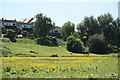
Buttercup Meadow
View to a pond across a meadow of buttercups
Image: © Richard Croft
Taken: 17 Jun 2010
0.06 miles
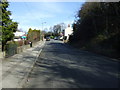

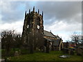
6
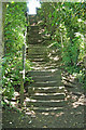
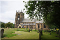
Church steps
Ancient steps ascending to the church
Image: © Richard Croft
Taken: 17 Jun 2010
0.11 miles
9
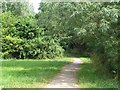
Trans-pennine Trail, Beighton
Looking up the TPT as it emerges from a pleasant off-road section after crossing across Beighton.
Image: © David Morris
Taken: 1 Jul 2006
0.17 miles
10
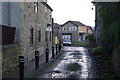
Tye Road, Beighton
This short unmade street provides a convenient cut through between the church and the High Street. It is also part of the Rother Valley Way.
Image: © Stephen McKay
Taken: 25 Feb 2007
0.17 miles