1
Paddock and farm buildings, Lydgate
Field and farm buildings on a bright day in late spring, moving towards early summer.
Image: © Andrew Hill
Taken: 31 May 2011
0.04 miles
2
Footpath northwest from Holmesfield Common
Path across the fields northwest from the B6054.
Image: © Andrew Hill
Taken: 31 May 2011
0.12 miles
3
Tree on Holmesfield Common
Image: © Neil Theasby
Taken: 25 Mar 2018
0.13 miles
4
After the Harvest
Harvested field at Lydgate, Holmesfield with a view of Sheffield's southern suburbs.
Image: © Neil Theasby
Taken: 11 Aug 2022
0.14 miles
5
The Robin Hood, Lydgate
Although by all appearances a thriving concern in 1998, this pub, like so many others, has since ceased to be. See
Image for a 2012 view.
Image: © Stephen McKay
Taken: Unknown
0.19 miles
6
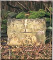
Old milestone
This milestone half way between Calver and Gleadless was eventually found hidden under bushes opposite the metal field gate by Gooseberry Farm. Now it should be easier to find as grass, twigs and branches were cleared away. These milestones date from after 1825 when the toll road was extended to Gleadless.
Left side - GLEADLESS/7/MILES. Right side - CALVER/7/MILES.
Image: © Chris Minto
Taken: 25 Oct 2024
0.21 miles
7
Old Robin Hood, Lydgate Hill, Holmsefield
30 years ago this was a fashionable pub, often standing room only, with an excellent reputation for food.
Not any more, but there are two gastro-pubs within a mile to the west, and another five within a mile to the east. Which is quite surprising when you see how few houses there are hereabouts. 100-300 years ago there must have been a lot of thirsty travellers.
This is a windy spot. That windmill has blown over completely once in the last 18 months, and suffered a badly distorted propeller blade and motor casing quite recently.
Image: © Chris Morgan
Taken: 26 Mar 2012
0.22 miles
8
Old milestone
Looking towards Holmesfield the position of the milestone half way between Calver and Gleadless which was almost hidden in vegetation can be appreciated.
Image: © Chris Minto
Taken: 25 Oct 2024
0.22 miles
9
Old Milestone by the B6054, near Gooseberry Farm
Carved stone post by the B6054, in parish of HOLMESFIELD (NORTH EAST DERBYSHIRE District), Dronfield Road; almost opposite Common End Cottages, on grass verge in front of stone wall, on South side of road. Calver twin panel, erected by the Owler Bar (Norton to Hathersage) turnpike trust in the 19th century.
Inscription reads:-
: GLEADLESS / 7 / MILES : : CALVER / 7 / MILES :
Grade II Listed. List Entry Number:1109632
https://historicengland.org.uk/listing/the-list/list-entry/1109632
Milestone Society National ID: DE_CAGL07.
Image: © J Higgins
Taken: 1 Nov 2002
0.22 miles
10
Fanshawe Gate Lane
9 clear days after the snow had arrived
Image: © Chris Morgan
Taken: 2 Apr 2013
0.22 miles


