
IMAGES TAKEN NEAR TO
Dobbin Lane, DRONFIELD, S18 7SU
Introduction
This page details the photographs taken nearby to Dobbin Lane, S18 7SU by members of the Geograph project.
The Geograph project started in 2005 with the aim of publishing, organising and preserving representative images for every square kilometre of Great Britain, Ireland and the Isle of Man.

There are currently over 7.5m images from over14,400 individuals and you can help contribute to the project by visiting https://www.geograph.org.uk
Image Map
Images are licensed for reuse under creativecommons.org/licenses/by-sa/2.0
Notes
- Clicking on the map will re-center to the selected point.
- The higher the marker number, the further away the image location is from the centre of the postcode.
Image Listing (7 Images Found)
Images are licensed for reuse under creativecommons.org/licenses/by-sa/2.0
Image
Details
Distance
2
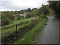
Lane up Peakley Hill
An attractive rural setting which is only around 2km from Dronfield.
Image: © Roger Temple
Taken: 20 Oct 2006
0.17 miles
4
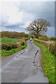
Dobbin Lane near Peakley Hill, Derbyshire
Image: © Neil Theasby
Taken: 26 Apr 2012
0.18 miles
5
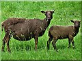
Brown sheep at Brindwoodgate
I am not certain about the breed and would be happy to receive advice.
Image: © Neil Theasby
Taken: 9 Jun 2019
0.22 miles
7
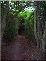
Holloway and Bridleway
This holloway runs for nearly a mile between Cartledge Hall and Brindwoodgate, and is shielded by a thick canopy of vegetation for most of its length. A ancient oak can be seen ahead poking above the thick gloom.
Image: © Jonathan Clitheroe
Taken: 7 May 2011
0.23 miles