
IMAGES TAKEN NEAR TO
Springbank, DRONFIELD, S18 4AD
Introduction
This page details the photographs taken nearby to Springbank, S18 4AD by members of the Geograph project.
The Geograph project started in 2005 with the aim of publishing, organising and preserving representative images for every square kilometre of Great Britain, Ireland and the Isle of Man.

There are currently over 7.5m images from over14,400 individuals and you can help contribute to the project by visiting https://www.geograph.org.uk
Image Map
Images are licensed for reuse under creativecommons.org/licenses/by-sa/2.0
Notes
- Clicking on the map will re-center to the selected point.
- The higher the marker number, the further away the image location is from the centre of the postcode.
Image Listing (44 Images Found)
Images are licensed for reuse under creativecommons.org/licenses/by-sa/2.0
Image
Details
Distance
1
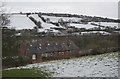
View across the Drone Valley
Spring Bank in the foreground and the Hallowes area of Dronfield on the far hill. The Midland Railway main line between Chesterfield and Sheffield is clearly visible.
Image: © Alan Murray-Rust
Taken: 23 Feb 2010
0.01 miles
2
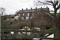
Spring Bank
Miners' housing associated with the local Unstone Main colliery, of which the nearer building is a remnant. Probably built around 1880.
Image: © Alan Murray-Rust
Taken: 23 Feb 2010
0.01 miles
3
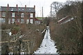
Footpath at Spring Bank
This is clearly visible on the oldest OS maps of the area and was doubtless a miners' or quarrymen's path. It links directly to the old Chesterfield to Sheffield main road.
Image: © Alan Murray-Rust
Taken: 23 Feb 2010
0.02 miles
4
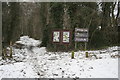
Unstone Line
Interpretative information about the Unstone Line walk, provided by Derbyshire County Council. It covers both natural and industrial history of the area
Image: © Alan Murray-Rust
Taken: 23 Feb 2010
0.05 miles
5
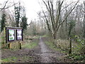
On the Unstone Line
Part of a promoted walk along the trackbed of a disused railway.
Image: © John Slater
Taken: 19 Feb 2014
0.06 miles
6
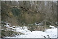
Unstone Main Colliery
This was probably the largest colliery of the group around Unstone, and has significant remains, although it ceased working around 1900. What can be seen here is a retaining wall at the back of the loading area for railway wagons.
Image: © Alan Murray-Rust
Taken: 23 Feb 2010
0.06 miles
7
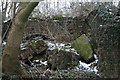
Unstone Main Colliery
This shows the ruins of the ventilating fan house, and indicates that this was a substantial mine. Smaller mines would use a fire at the base of a shaft to provide a ventilating draught.
The curve in the brickwork to the right of the picture shows how the building would be profiled to surround the fan, which would have been around 20 feet in diameter. The arched opening at the back is the inlet into the fan from the mine shaft.
Image: © Alan Murray-Rust
Taken: 23 Feb 2010
0.06 miles
8
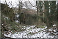
Colliery remains near Unstone
Probably part of a loading wharf for railway wagons.
Image: © Alan Murray-Rust
Taken: 23 Feb 2010
0.12 miles
9
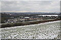
Derbyshire landscape
A long line of terraced cottages crosses what appears to be a rural landscape. At the end of the 19th century there were several coal mines in the immediate vicinity, and the landscape would have been more industrial, as there were several banks of coking ovens attached to the pits.
Image: © Alan Murray-Rust
Taken: 23 Feb 2010
0.13 miles
10
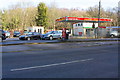
Unstone Hand Car Wash, Unstone Hill
Image: © Roger Templeman
Taken: 11 Feb 2019
0.13 miles