IMAGES TAKEN NEAR TO
Lee Croft, SHEFFIELD, S1 2DY

Introduction

This page details the photographs taken nearby to Lee Croft, S1 2DY by members of the Geograph project.

The Geograph project started in 2005 with the aim of publishing, organising and preserving representative images for every square kilometre of Great Britain, Ireland and the Isle of Man.

There are currently over 7.5m images from over14,400 individuals and you can help contribute to the project by visiting https://www.geograph.org.uk

Image Map


Images are licensed for reuse under creativecommons.org/licenses/by-sa/2.0
Notes
  • Clicking on the map will re-center to the selected point.
  • The higher the marker number, the further away the image location is from the centre of the postcode.

Image Listing (1427 Images Found)

Images are licensed for reuse under creativecommons.org/licenses/by-sa/2.0
  • ...
Image
Details
Distance
1
Central Elim Pentecostal Church
Image: © N Chadwick Taken: 29 Aug 2015
0.01 miles
2
Vicar Lane
Image: © N Chadwick Taken: 29 Aug 2015
0.01 miles
3
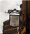
Three Tuns
Image: © N Chadwick Taken: 29 Aug 2015
0.01 miles
4
Paradise Street, Sheffield
Image: © Stanley Walker Taken: 31 Aug 2009
0.01 miles
5
Sheffield, S1 - Silver Street Head
The Three Tuns pub (literally The pub of the three large casks) at the point where Silver Street Head and Lee Croft join Tenter Street (B6539). A left turn into Tenter Street (in the opposite direction to the one that the white car is moving in) will lead the traveller to the University of Sheffield and the Children's Hospital. Sadly large apartment blocks and office blocks have proliferated in this area leaving older buildings like this pub looking very isolated.
Image: © David Hallam-Jones Taken: 27 Oct 2012
0.01 miles
6
Paradise Square, west side
Paradise Square was laid out in about 1770 and most of the buildings, though restored, date from that time. Most of the houses are now in use as offices.
Image: © Jonathan Thacker Taken: 15 Dec 2012
0.02 miles
7
Three Tuns
An acutely triangular pub on Solly Street. Grade II listed: List Entry Number:1247378 https://historicengland.org.uk/listing/the-list/list-entry/1247378
Image: © David Lally Taken: 19 May 2021
0.02 miles
8
The sign of the Three Tuns
Image: © David Lally Taken: 19 May 2021
0.02 miles
9
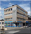
55-66 Campo Lane, Sheffield
Modest 1960s building, shop at street level and offices above. The former now a branch of convenience stores, Mace. Faded lettering reads "Sheffield Building Society".
Image: © Stephen Richards Taken: 10 Jun 2012
0.02 miles
10
Campo Lane, Sheffield
The Wig & Pen and Craft & Dough, Trippet Lane, are combined enterprises under the same roof, providing alcoholic and non-alcoholic beverages to complement their artisan bakery products, for consumption on or off the premises. A ‘dough off’, as opposed to a ‘beer off”? This establishment is situated at the rear of the Anglican cathedral and is also surrounded by the offices of legal firms. Therefore, it probably does excellent business Monday - Friday.
Image: © David Hallam-Jones Taken: 19 Feb 2018
0.02 miles
  • ...