1
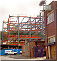
Sheffield: the Three Tuns
A pub on the extraordinarily thin wedge-shaped corner of Lee Croft and Silver Street Head.
Image: © Chris Downer
Taken: 26 Apr 2008
0.01 miles
2
Edward Street apartments under construction by Clegg.
Image: © Steve Fareham
Taken: 18 Sep 2007
0.01 miles
3
Paradise Street, Sheffield
Looking north from the east side of Paradise Square.
From many places in the heart of the city are views out to green space.
Image: © Stephen Richards
Taken: 10 Jun 2012
0.02 miles
4
Sheffield: Paradise Square
An unexpectedly picturesque scene that takes one by surprise having walked through the mainly nondescript streets of the city centre.
The square is on quite a slope, as shown by this alternative view:
Image
Image: © Chris Downer
Taken: 26 Apr 2008
0.02 miles
5
Wheats Lane
Looking from North Church Street to Paradise Square.
Image: © Jonathan Thacker
Taken: 15 Dec 2012
0.02 miles
6
Benchmark on wall outside #12 Paradise Square
Ordnance Survey cut mark benchmark described on the Bench Mark Database at http://www.bench-marks.org.uk/bm36742
Image: © Roger Templeman
Taken: 3 Feb 2011
0.02 miles
7
Paradise Square, east side
Paradise Square was laid out in about 1770 and most of the buildings, though restored, date from that time. Most of the houses are now in use as offices.
Image: © Jonathan Thacker
Taken: 15 Dec 2012
0.02 miles
8
Plaque of David Daniel Davis, Paradise Square, Sheffield
Image: © Nick Morris
Taken: 4 Jun 2014
0.02 miles
9
Cut Mark 12 Paradise Square Sheffield
Image: © Monica Stagg
Taken: 22 Jul 2015
0.02 miles
10
Wheats Lane, Sheffield
A view, eastwards, from Paradise Square to North Church Street, with a glimpse of the tall former synagogue in the distance. Wheats Lane is thought to be named after John James Wheat of Treeton who established a solicitor’s practice in Paradise Square in 1777. “James”, as he became known, was active in his practice from about 1766 - (having taken it over of William Battie, another active Sheffield solicitor) - to his death in 1805. He was clerk to a number of Sheffield trusts, charities and commissions, the Law Clerk to the Burgesses from March 1766 onwards, and in 1778 he was elected to serve as one of the Burgesses. The Wheat family and practice continued to serve as Law Clerks to the Church Burgesses via John James Wheat (1825-1915) and John Bristow Wheat (1858-1936). The administrative papers of the Burgesses, including the Wheat Collection, are held by the Sheffield Archives and are valuable resources, because of the light that they throw on the city's development.
Image: © David Hallam-Jones
Taken: 19 Feb 2018
0.02 miles


