
IMAGES TAKEN NEAR TO
Hollybank Crescent, SHEFFIELD, S12 2BP
Introduction
This page details the photographs taken nearby to Hollybank Crescent, S12 2BP by members of the Geograph project.
The Geograph project started in 2005 with the aim of publishing, organising and preserving representative images for every square kilometre of Great Britain, Ireland and the Isle of Man.

There are currently over 7.5m images from over14,400 individuals and you can help contribute to the project by visiting https://www.geograph.org.uk
Image Map
Images are licensed for reuse under creativecommons.org/licenses/by-sa/2.0
Notes
- Clicking on the map will re-center to the selected point.
- The higher the marker number, the further away the image location is from the centre of the postcode.
Image Listing (17 Images Found)
Images are licensed for reuse under creativecommons.org/licenses/by-sa/2.0
Image
Details
Distance
3
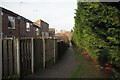
Path beside Intake Cemetery
The cemetery is hidden by the large leylandii hedge. On the left is the rear of the houses on Mansfield Drive.
Image: © David Lally
Taken: 8 Feb 2023
0.13 miles
4
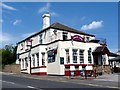
The Noahs Ark
The first time I've seen a pub that advertises its availability for funerals so prominently. And an ironic juxtaposition with the advert for live entertainment!
Image: © Graham Hogg
Taken: 30 May 2012
0.14 miles
5
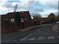
Carpenter Gardens Sheffield 3 - Junction with Hollybank Road
Image: © Neil Theasby
Taken: 22 Oct 2010
0.14 miles
6
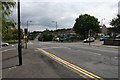
Hollins End / Four Lanes End
This is the junction of Hollins End Road (to the right - SW), Hollybank Road (left - NE) and Mansfield Road (SE - NW). I'm standing outside the Co-op, but once on this junction stood the Rex Cinema and a Workingmen's club. I think the former is occupied by the Co-op and the latter by a nursing home.
Image: © David Morris
Taken: 26 Aug 2006
0.14 miles
7
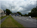
Car showrooms, Richmond, Sheffield
At the junction of Richmond Road and Normanton Hill.
Image: © Peter Barr
Taken: 19 Jul 2011
0.20 miles
8
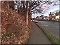
Sandstone outcrop on Richmond Road
Site of an OS benchmark. Image
Image: © David Lally
Taken: 19 Feb 2023
0.21 miles
9
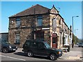
"Men Zone" Hairdressing Salon, Mansfield Road, Sheffield
Image: © Neil Theasby
Taken: 1 Sep 2011
0.21 miles
10
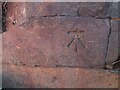
OS benchmark
On a living rock outcrop on Richmond Road.
Image
This is a cut benchmark, 0.2m above the ground and 171.24m above the Ordnance Datum at Newlyn. It was last verified in 1966. Grid Reference: SK 3913 8493. Description: LIVING ROCK N SIDE RICHMOND RD 2.0M E PATH NO 548
Image: © David Lally
Taken: 19 Feb 2023
0.21 miles