IMAGES TAKEN NEAR TO
Carr Bank Close, SHEFFIELD, S11 7FJ

Introduction

This page details the photographs taken nearby to Carr Bank Close, S11 7FJ by members of the Geograph project.

The Geograph project started in 2005 with the aim of publishing, organising and preserving representative images for every square kilometre of Great Britain, Ireland and the Isle of Man.

There are currently over 7.5m images from over14,400 individuals and you can help contribute to the project by visiting https://www.geograph.org.uk

Image Map


Images are licensed for reuse under creativecommons.org/licenses/by-sa/2.0
Notes
  • Clicking on the map will re-center to the selected point.
  • The higher the marker number, the further away the image location is from the centre of the postcode.

Image Listing (49 Images Found)

Images are licensed for reuse under creativecommons.org/licenses/by-sa/2.0
  • ...
Image
Details
Distance
1
Bramwith Road, Nether Green, Sheffield
Image: © Neil Theasby Taken: 6 Oct 2010
0.06 miles
2
Allotment tenant by his shed at Hanging Water
Image: © Neil Theasby Taken: 13 Apr 2016
0.08 miles
3
Nether Green, Sheffield
Looking towards the spire of St John's Church at Ranmoor.
Image: © Neil Theasby Taken: 5 Feb 2021
0.10 miles
4
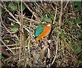
Kingfisher in Bingham Park, Sheffield
Spotted by the millpond next to The Shepherd's Wheel heritage complex.
Image: © Neil Theasby Taken: 27 Jan 2019
0.11 miles
5
Shepherd's Wheel, Sheffield
Shepherd Wheel is a working museum in a former water-powered grinding workshop situated on the Porter Brook in the south-west of the City of Sheffield, England. One of the earliest wheels on the River Porter, it is one of the few remaining—and effectively complete—examples of this kind of enterprise, one that used to be commonplace in the Sheffield area. Its 5.5 m (18 ft) diameter overshot water wheel is powered from a large dam stocked with water diverted from the Porter Brook. The workshops, dam, goit and weir are Grade II listed, and the site is a Scheduled Ancient Monument. Wikipedia contributors, "Shepherd Wheel," Wikipedia, The Free Encyclopedia, http://en.wikipedia.org/w/index.php?title=Shepherd_Wheel&oldid=652735260 (accessed April 14, 2015).
Image: © Nick Morris Taken: 2 Apr 2015
0.12 miles
6
Shepherd Wheel - Wall Plaque
Description of the water-powered grinding hull last worked in the 1930's. Image
Image: © Alan Heardman Taken: 22 Jan 2009
0.12 miles
7
The Shepherd Wheel complex in Bingham Park
By The River Porter. Last used commercially in the 1930's, The Shepherd Wheel Mill was connected with farmland and farming activity north of the Porter before Sheffield's suburban housing spread further south and westwards.
Image: © Neil Theasby Taken: 13 Apr 2016
0.13 miles
8
Porter Brook and path
Looking along a foot/cycle path beside Porter Brook.
Image: © DS Pugh Taken: 24 Aug 2018
0.13 miles
9
Shepherd Wheel mill pond
Water diverted here from the Porter Brook is used to power Shepherd Wheel Image,the only surviving water wheel of 19 that were once operating in the Porter Valley
Image: © Graham Hogg Taken: 3 Sep 2018
0.13 miles
10
Preening duck in The Porter Brook
Image: © Neil Theasby Taken: 13 Apr 2016
0.13 miles
  • ...