
IMAGES TAKEN NEAR TO
Sandygate Park, SHEFFIELD, S10 5TZ
Introduction
This page details the photographs taken nearby to Sandygate Park, S10 5TZ by members of the Geograph project.
The Geograph project started in 2005 with the aim of publishing, organising and preserving representative images for every square kilometre of Great Britain, Ireland and the Isle of Man.

There are currently over 7.5m images from over14,400 individuals and you can help contribute to the project by visiting https://www.geograph.org.uk
Image Map
Images are licensed for reuse under creativecommons.org/licenses/by-sa/2.0
Notes
- Clicking on the map will re-center to the selected point.
- The higher the marker number, the further away the image location is from the centre of the postcode.
Image Listing (15 Images Found)
Images are licensed for reuse under creativecommons.org/licenses/by-sa/2.0
Image
Details
Distance
1
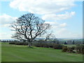
Winter tree on Hallamshire golf course
A hazard on the 18th hole! The golf course has superb views over the Rivelin Valley.
Image: © Graham Hogg
Taken: 18 Mar 2011
0.13 miles
2
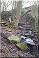
Ascending through Hagg Wood from Coppice Road
Image: © Chris Morgan
Taken: 1 Apr 2010
0.13 miles
3
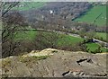
View over The Rivelin Valley
From rocks by Hagg Wood, looking over the A57 towards the old King Edward VII Hospital site (Top middle) - now residential.
Image: © Neil Theasby
Taken: 30 Mar 2019
0.14 miles
4
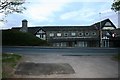
Hallamshire Golf Course Clubhouse
The clubhouse of this high level golf course
Image: © Keith Pitchforth
Taken: 27 Apr 2010
0.15 miles
5
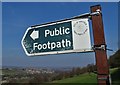
Footpath sign by Coppice Road
Looking towards Stannington above The Rivelin Valley
Image: © Neil Theasby
Taken: 30 Mar 2019
0.16 miles
6
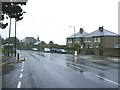
Sandygate Road, Sheffield
Looking down Sandygate Road towards Sheffield. The junction with Pitchford Lane is on the right.
Image: © Brian Ward
Taken: 25 Oct 2006
0.18 miles
7
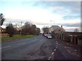
Sandygate Road in Crosspool
Looking along Sandygate Road from its junction with Pitchford Lane.
Image: © Jonathan Clitheroe
Taken: 22 Nov 2011
0.20 miles
8
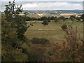
View across Hallamshire Golf Course from Lodge Moor
Image: © Neil Theasby
Taken: 23 Aug 2011
0.20 miles
9
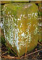
Old Milestone by the A57, Manchester Road, Sheffield Parish
Carved stone post by the A57, in parish of SHEFFIELD (SHEFFIELD District), Manchester Road, 0.2 mile West of Bell Hagg PH (closed), by wall near where stream runs under road, on South side of road. Erected by the Sheffield & Glossop turnpike trust in the 19th century.
Inscription reads:- : MANC / 35 : : SHEFF / 3 :
Carved benchmark and rivet on bevel.
Milestone Society National ID: YS_SFGP03.
Image: © C Minto
Taken: 24 Feb 2007
0.21 miles
10
Manchester Road (A57) towards Sheffield
Looking north east.
Image: © JThomas
Taken: 13 Jun 2018
0.21 miles