IMAGES TAKEN NEAR TO
Hallam Grange Rise, SHEFFIELD, S10 4BG
Introduction
This page details the photographs taken nearby to Hallam Grange Rise, S10 4BG by members of the Geograph project.
The Geograph project started in 2005 with the aim of publishing, organising and preserving representative images for every square kilometre of Great Britain, Ireland and the Isle of Man.

There are currently over 7.5m images from over14,400 individuals and you can help contribute to the project by visiting https://www.geograph.org.uk
Image Map
Images are licensed for reuse under creativecommons.org/licenses/by-sa/2.0
Notes
- Clicking on the map will re-center to the selected point.
- The higher the marker number, the further away the image location is from the centre of the postcode.
Image Listing (26 Images Found)
Images are licensed for reuse under creativecommons.org/licenses/by-sa/2.0
Image
Details
Distance
1
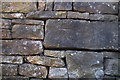
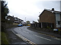
Cut Mark on the wall of 5 Hallam Grange Road
Image: © Keith Pitchforth
Taken: 22 Mar 2020
0.09 miles
7

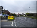
Cut Mark Outbuilding junction Hallam Grange Cres Sheffield
Image: © Monica Stagg
Taken: 28 Jun 2015
0.17 miles

10
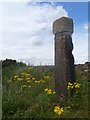
The Barncliff Stoop
The Barncliff Stoop (Scandinavian for a stone post) was one of a series of pillars marking the route of The Long Causeway, an ancient, possibly prehistoric track leading out of Sheffield. (Older OS maps show the track as a Roman road, but modern publications suggest it is more likely to have medieval origins). The next way-marker was located outside the old Lodge Moor Hospital until 1903. Each waymarker was positioned so as to be visible against the skyline from the neighbouring posts. The Long Causeway is believed to have followed the line of Redmires Road to Wyming Brook, on via Stanedge Pole, along Stanage Edge, and down Coggers Lane into Hathersage. In 1738 a milestone was added to the top of the stoop, but was removed, probably in 1870. The stoop was restored in 2002 with a replica of the milestone restored to the top of the stoop.
Image: © Martin Speck
Taken: 16 Jul 2009
0.20 miles