IMAGES TAKEN NEAR TO
Havelock Street, SHEFFIELD, S10 2FP
Introduction
This page details the photographs taken nearby to Havelock Street, S10 2FP by members of the Geograph project.
The Geograph project started in 2005 with the aim of publishing, organising and preserving representative images for every square kilometre of Great Britain, Ireland and the Isle of Man.

There are currently over 7.5m images from over14,400 individuals and you can help contribute to the project by visiting https://www.geograph.org.uk
Image Map
Images are licensed for reuse under creativecommons.org/licenses/by-sa/2.0
Notes
- Clicking on the map will re-center to the selected point.
- The higher the marker number, the further away the image location is from the centre of the postcode.
Image Listing (374 Images Found)
Images are licensed for reuse under creativecommons.org/licenses/by-sa/2.0
Image
Details
Distance
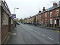
1
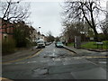
Looking from Broomspring Lane into Havelock Street
Image: © Basher Eyre
Taken: 4 Apr 2012
0.03 miles
6
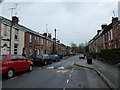
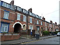
Traffic calming measure in Brunswick Street
Image: © Basher Eyre
Taken: 4 Apr 2012
0.04 miles
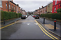
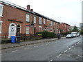
9
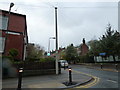
Telegraph pole at the junction of Broomspring Lane and Brunswick Street
Image: © Basher Eyre
Taken: 4 Apr 2012
0.04 miles
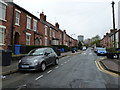
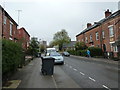
10
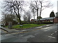
Junction of Broomspring Lane and Havelock Street
Image: © Basher Eyre
Taken: 4 Apr 2012
0.04 miles