IMAGES TAKEN NEAR TO
Mackenzie Crescent, SHEFFIELD, S10 2BU
Introduction
This page details the photographs taken nearby to Mackenzie Crescent, S10 2BU by members of the Geograph project.
The Geograph project started in 2005 with the aim of publishing, organising and preserving representative images for every square kilometre of Great Britain, Ireland and the Isle of Man.

There are currently over 7.5m images from over14,400 individuals and you can help contribute to the project by visiting https://www.geograph.org.uk
Image Map
Images are licensed for reuse under creativecommons.org/licenses/by-sa/2.0
Notes
- Clicking on the map will re-center to the selected point.
- The higher the marker number, the further away the image location is from the centre of the postcode.
Image Listing (162 Images Found)
Images are licensed for reuse under creativecommons.org/licenses/by-sa/2.0
Image
Details
Distance
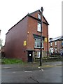
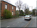
2
Looking from Clarke Street into Wharncliffe Road
Image: © Basher Eyre
Taken: 4 Apr 2012
0.05 miles
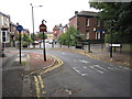
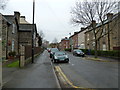
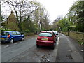
5
Looking from Wharncliffe Road over to the boundary of Brunswick Street and Collegiate Crescent
Image: © Basher Eyre
Taken: 4 Apr 2012
0.05 miles
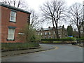
6
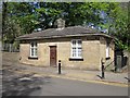
Lodge on Broomhall Road
This hints at an earlier age when the ordinary folk of Sheffield were discouraged from entering the wealthier suburbs.
Image: © Patrick Mackie
Taken: 12 May 2012
0.05 miles
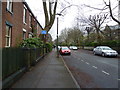
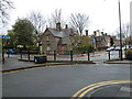
8
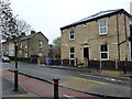
Houses at the southern end of Brunswick Street
Image: © Basher Eyre
Taken: 4 Apr 2012
0.06 miles