1
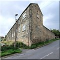
Toftwood Road, Crookes
These must be about the only open plan front gardens around.
Image: © Dave Hitchborne
Taken: 26 Aug 2008
0.03 miles
2
Bolehill Lane, Crookes
At its junction with Tinker Lane. I once carried my wife all the way up this hill.
Image: © Dave Hitchborne
Taken: 26 Aug 2008
0.04 miles
3
Bolehill Lane, Crookes
These are Cocked Hat Cottages, that were built around 1860. The Unwin family owned a quarry on the Bolehills and lived here. This end of the building was a stable with hay loft. The un-surfaced lane that ran by was called Cocked Hat Lane, from which the cottages took their name.
Tinker Lane, which ends here at Bolehill Lane, rises here by 105 metres on its way up from Bole Hill Road. I once carried my wife all the way up.
Image: © Dave Hitchborne
Taken: 26 Aug 2008
0.04 miles
4
Bolehill Lane, Crookes
I took this photograph just to replicate this one taken 40-years-ago - http://www.geograph.org.uk/photo/2176841
Image: © Dave Hitchborne
Taken: 26 Aug 2008
0.04 miles
5
Bolehill Lane, Crookes
Taken when Stannington, across the valley, was still a village. A more recent photograph - http://www.geograph.org.uk/photo/2176831
Image: © Dave Hitchborne
Taken: Unknown
0.04 miles
6
The Bolehills, near Crookes
As you walk down Bolehill Lane there's nothing to suggest that this is a recreational area. No plaque, no map, no history. There are at least three other ways in and last time I looked there wasn't anything there either.
Image: © Dave Hitchborne
Taken: 26 Aug 2008
0.04 miles
7
Fire! Toftwood Road, Crookes
Fire engine on Toftwood Road, Crookes. It had just answered a call to a house opposite and appeared to be answering another.
Image: © Dave Hitchborne
Taken: Unknown
0.05 miles
8
Bolehill Lane, Crookes
Sign outside these cottages - http://www.geograph.org.uk/photo/2176565
Image: © Dave Hitchborne
Taken: 26 Aug 2008
0.05 miles
9
Bolehill Lane, Crookes
Bolehill Lane meets Toftwood Road, to the left and Toftwood Avenue, to the right. If you carry on straight across the junction and walk to the end of Bolehill Lane, before it takes a sharp bend to the right, there is a nice walk down to Clough Fields and several equally nice options to make your way down to the Rivelin Valley. I used to walk down there alone, when my age was in the single figures and there never was any reason to worry about doing so.
There is a very pretty walk, in the valley, that follows the river from Glen Bridge to Rivelin Mill Bridge. My wife and I have walked that and carried on through to Baslow and back.
Image: © Dave Hitchborne
Taken: 26 Aug 2008
0.05 miles
10
Toftwood Road, Crookes
A familiar scene to me, from the age of seven. I lived at both the bottom of the road and then the top, from 1949 until 1973.
Image: © Dave Hitchborne
Taken: 26 Aug 2008
0.05 miles


