1
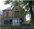
Crookesmoor Road
Looking along the largely residential street from the Barber Road junction.
Image: © Andrew Hill
Taken: 25 Jun 2011
0.05 miles
2
Crookes Valley Junction, Crookes Valley, Sheffield - 2
Crookesmoor Road runs from top to bottom, Crookes Valley Road runs off to the left.
The car is emerging from Barber Road.
See also ...
Image
Image
Image: © Terry Robinson
Taken: 1 Sep 2012
0.07 miles
3
Former Crookes Valley Methodist Church, Sheffield
This Grade II-listed building was constructed as St John’s Wesleyan Methodist Church and School in 1881 at a cost of £7000. However, when St Luke’s Wesleyan Methodist Church, Northfield Road, Crookes closed in 1965, and its congregation joined forces to share this building, it was renamed Crookes Valley Methodist Church. The ‘new’ church closed in 2003 and after standing empty for years, it was converted into private residential apartments of varying sizes and renamed Heritage Hall & Lodge. Crookes and Broomhill can be reached behind the photographer via the upper section of Crookesmoor Road. In the opposite direction Crookesmoor Road descends towards the part of Sheffield where the Royal Infirmary once stood, on Langsett Road.
Image: © David Hallam-Jones
Taken: 19 Feb 2018
0.07 miles
4
Sheffield - No 88 Harcourt Road
Showing brickwork detail. For a wider view of the houses on Harcourt Road, please see
Image
Image: © Dave Bevis
Taken: 26 Oct 2013
0.07 miles
5
Crookes Valley Medical and Dental Practice, Barber Road, Crookes Valley, Sheffield
Situated on Crookes Valley Junction ... see also ...
Image
Image: © Terry Robinson
Taken: 1 Sep 2012
0.07 miles
6
Second Hand Centre, Crookes Valley Road, Crookes Valley, Sheffield
The plaque set into the brick wall reads ... CROOKES MOOR HOUSE AD 1881
See also ...
Image
Image
Image: © Terry Robinson
Taken: 1 Sep 2012
0.07 miles
7
45 Marlborough Road, Broomhill, Sheffield - 3
For more information and views see ...
Image
Image
Image: © Terry Robinson
Taken: 1 Sep 2012
0.07 miles
8
45 Marlborough Road, Broomhill, Sheffield - 1
This, now dilapidated mansion, was the former home of Adela Pankhurst, Secretary to the Sheffield Suffragettes' Movement ... the building was probably also used for meetings.
Seb Coe's parents also had a house in Marlborough Road ... and he was often seen running in the area.
See also ...
Image
Image
Image: © Terry Robinson
Taken: 1 Sep 2012
0.07 miles
9
Sheffield - houses on Harcourt Road
Predominantly accommodation for students at nearby Sheffield University.
Image: © Dave Bevis
Taken: 26 Oct 2013
0.08 miles
10
Barber Road above Crookesmoor Road
Looking uphill with various shops on the right hand side of the street.
Image: © Andrew Hill
Taken: 25 Jun 2011
0.08 miles


