IMAGES TAKEN NEAR TO
Noak Hill Road, ROMFORD, RM3 7LS
Introduction
This page details the photographs taken nearby to Noak Hill Road, RM3 7LS by members of the Geograph project.
The Geograph project started in 2005 with the aim of publishing, organising and preserving representative images for every square kilometre of Great Britain, Ireland and the Isle of Man.

There are currently over 7.5m images from over14,400 individuals and you can help contribute to the project by visiting https://www.geograph.org.uk
Image Map
Images are licensed for reuse under creativecommons.org/licenses/by-sa/2.0
Notes
- Clicking on the map will re-center to the selected point.
- The higher the marker number, the further away the image location is from the centre of the postcode.
Image Listing (37 Images Found)
Images are licensed for reuse under creativecommons.org/licenses/by-sa/2.0
Image
Details
Distance
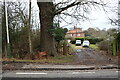
5
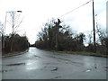
Noak Hill Road at the junction of Church Road
Image: © David Howard
Taken: 5 Mar 2017
0.10 miles
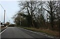
6
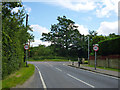
Road junction, Noak Hill
Church Road meets Noak Hill Road.
Image: © Robin Webster
Taken: 30 Jun 2012
0.11 miles
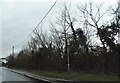
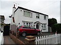
9
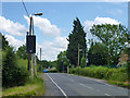
Speed limit warning sign, Noak Hill
It lights up if the 30 limit is exceeded.
Image: © Robin Webster
Taken: 30 Jun 2012
0.18 miles
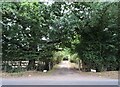
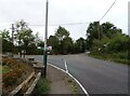
10
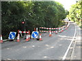
Harold Hill: Noak Hill Road
Traffic lights control vehicle movements while a service is laid under Noak Hill Road in August 2013.
Image: © Nigel Cox
Taken: 26 Aug 2013
0.22 miles