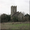
IMAGES TAKEN NEAR TO
Church Road, TILBURY, RM18 8UB

Introduction

This page details the photographs taken nearby to Church Road, RM18 8UB by members of the Geograph project.

The Geograph project started in 2005 with the aim of publishing, organising and preserving representative images for every square kilometre of Great Britain, Ireland and the Isle of Man.

There are currently over 7.5m images from over14,400 individuals and you can help contribute to the project by visiting https://www.geograph.org.uk

Image Map


Images are licensed for reuse under creativecommons.org/licenses/by-sa/2.0
Notes
  • Clicking on the map will re-center to the selected point.
  • The higher the marker number, the further away the image location is from the centre of the postcode.

Image Listing (21 Images Found)

Images are licensed for reuse under creativecommons.org/licenses/by-sa/2.0
  • ...
Image
Details
Distance
1
Audawn Coaches JAP698 at West Tilbury – 1972
Parked on the church green for a photographic stop in the course of a bus enthusiasts' tour. This coach was built by Thomas Harrington Ltd of Hove in 1954 as a demonstration vehicle for potential customers, using the 'Contender' style name. It was an integral-build body using Commer running units, and in its time was considered an attractive vehicle. After a short period in Bootle, it spent most of its life with Audawn Coaches and later went into preservation. This is one of a series of views featuring buses in the 60s, 70s, and 80s. http://www.geograph.org.uk/search.php?i=137652761
Image: © Alan Murray-Rust Taken: 24 Aug 1972
0.03 miles
2
West Tilbury church
St. James's is a grade II*(star) listed building.
Image: © Robin Webster Taken: 10 Jul 2011
0.04 miles
3
West Tilbury St James
Without trespassing, this is the closest that one can get to St James' Church from this direction. It is now privately owned as a residence. The land you see in the foreground is farmland. http://www.essexchurches.info/church.asp?p=West+Tilbury
Image: © John Whitworth Taken: 9 Jan 2004
0.04 miles
4
St James, West Tilbury
The church was made redundant in 1980 and is now a private dwelling
Image: © David Kemp Taken: 4 Dec 2011
0.04 miles
5
West Tilbury church
St. James's is a grade II*(star) listed building.
Image: © Robin Webster Taken: 10 Jul 2011
0.05 miles
6
Paddock on Hall Hill
On Church Road, overlooking Tilbury Power Station.
Image: © David Anstiss Taken: 16 Oct 2012
0.10 miles
7
Former public house sign, West Tilbury
Although the 'King's Head' closed in around 2015, its sign remains on the village green.
Image: © David Kemp Taken: 28 Jan 2022
0.14 miles
8
Stocks, West Tilbury
This old fashioned torture implement is on the village green beside Rectory Road.
Image: © David Anstiss Taken: 16 Oct 2012
0.15 miles
9
View from Coopers Shaw Road, West Tilbury
Image: © David Howard Taken: 22 Oct 2023
0.15 miles
10
The Green, West Tilbury (2022)
The building on the right is the former 'King's Head' public house which closed in around 2015.
Image: © David Kemp Taken: 28 Jan 2022
0.15 miles
  • ...