IMAGES TAKEN NEAR TO
Bruces Wharf Road, GRAYS, RM17 6PE
Introduction
This page details the photographs taken nearby to Bruces Wharf Road, RM17 6PE by members of the Geograph project.
The Geograph project started in 2005 with the aim of publishing, organising and preserving representative images for every square kilometre of Great Britain, Ireland and the Isle of Man.

There are currently over 7.5m images from over14,400 individuals and you can help contribute to the project by visiting https://www.geograph.org.uk
Image Map
Images are licensed for reuse under creativecommons.org/licenses/by-sa/2.0
Notes
- Clicking on the map will re-center to the selected point.
- The higher the marker number, the further away the image location is from the centre of the postcode.
Image Listing (141 Images Found)
Images are licensed for reuse under creativecommons.org/licenses/by-sa/2.0
Image
Details
Distance
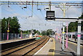
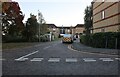
1
Bruce's Wharf Road, Grays
Looking from Church Path towards Argent Street.
Image: © Robin Webster
Taken: 19 Jun 2011
0.04 miles
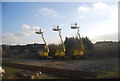
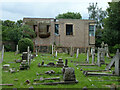
5
Looking along Argent St towards the old gasworks
Image: © N Chadwick
Taken: 8 Nov 2009
0.08 miles
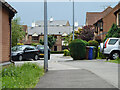
6
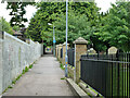
Church Path, Grays
Thurrock footpath 124 from Wharf Road to the High Street.
Image: © Robin Webster
Taken: 19 Jun 2011
0.08 miles
8
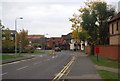
Lewes Close, Grays
Many of these roads are named after places in Sussex and Kent.
Image: © David Howard
Taken: 22 Oct 2023
0.09 miles
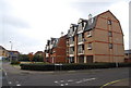
9
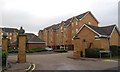
Timber Court, Columbia Wharf Rd
A new development reflecting the past use of the area.
Image: © N Chadwick
Taken: 8 Nov 2009
0.09 miles