IMAGES TAKEN NEAR TO
Duarte Place, GRAYS, RM16 6PH
Introduction
This page details the photographs taken nearby to Duarte Place, RM16 6PH by members of the Geograph project.
The Geograph project started in 2005 with the aim of publishing, organising and preserving representative images for every square kilometre of Great Britain, Ireland and the Isle of Man.

There are currently over 7.5m images from over14,400 individuals and you can help contribute to the project by visiting https://www.geograph.org.uk
Image Map
Images are licensed for reuse under creativecommons.org/licenses/by-sa/2.0
Notes
- Clicking on the map will re-center to the selected point.
- The higher the marker number, the further away the image location is from the centre of the postcode.
Image Listing (39 Images Found)
Images are licensed for reuse under creativecommons.org/licenses/by-sa/2.0
Image
Details
Distance
6
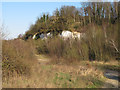
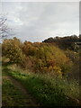
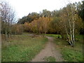
Path and Cliffs near Grays Gorge
This path leads from Devonshire Road along the north of Grays Gorge, part of Chafford Gorges Nature Park.
Note the chalk cliffs in the background, in this area which was once a quarry.
Image: © Roger Jones
Taken: 6 Apr 2013
0.10 miles
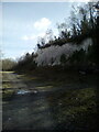
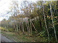
8
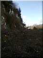
Cliffs near Grays Gorge
A large number of young trees have recently been felled.
Image: © Adrian Benn
Taken: 27 Mar 2021
0.11 miles
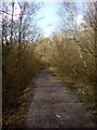
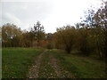
9
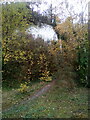
A steep path alongside chalk cliffs
A path leading up to Meeson's Lane
Image: © Adrian Benn
Taken: 14 Nov 2020
0.12 miles