IMAGES TAKEN NEAR TO
Victoria Avenue, GRAYS, RM16 2RN
Introduction
This page details the photographs taken nearby to Victoria Avenue, RM16 2RN by members of the Geograph project.
The Geograph project started in 2005 with the aim of publishing, organising and preserving representative images for every square kilometre of Great Britain, Ireland and the Isle of Man.

There are currently over 7.5m images from over14,400 individuals and you can help contribute to the project by visiting https://www.geograph.org.uk
Image Map
Images are licensed for reuse under creativecommons.org/licenses/by-sa/2.0
Notes
- Clicking on the map will re-center to the selected point.
- The higher the marker number, the further away the image location is from the centre of the postcode.
Image Listing (15 Images Found)
Images are licensed for reuse under creativecommons.org/licenses/by-sa/2.0
Image
Details
Distance
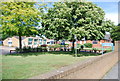
4
Roundabout, Connaught Avenue / Long Lane
Image: © N Chadwick
Taken: 18 Jun 2011
0.15 miles
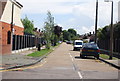
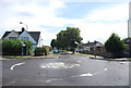
6

Mini Roundabout on Long Lane, Little Thurrock
Long Lane leads straight on towards the A1012 Lodge Lane.
Connaught Avenue leads left towards Lodge Lane (near the town centre).
Fairway leads right.
Image: © David Anstiss
Taken: 25 Nov 2012
0.16 miles