IMAGES TAKEN NEAR TO
Bone Mill Lane, GODSTONE, RH9 8EX
Introduction
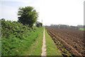
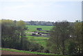
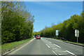
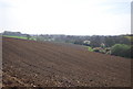
This page details the photographs taken nearby to Bone Mill Lane, RH9 8EX by members of the Geograph project.
The Geograph project started in 2005 with the aim of publishing, organising and preserving representative images for every square kilometre of Great Britain, Ireland and the Isle of Man.

There are currently over 7.5m images from over14,400 individuals and you can help contribute to the project by visiting https://www.geograph.org.uk
Image Map
Images are licensed for reuse under creativecommons.org/licenses/by-sa/2.0
Notes
- Clicking on the map will re-center to the selected point.
- The higher the marker number, the further away the image location is from the centre of the postcode.
Image Listing (18 Images Found)
Images are licensed for reuse under creativecommons.org/licenses/by-sa/2.0
Image
Details
Distance
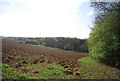
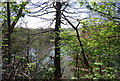
8
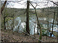
Lake south of Castlehill Wood
The wooded slope above the lake makes it awkward to get a good view from the public footpath, even in winter. It appears to be used for fishing.
Image: © Robin Webster
Taken: 28 Jan 2011
0.15 miles