
IMAGES TAKEN NEAR TO
Flower Lane, GODSTONE, RH9 8DG
Introduction
This page details the photographs taken nearby to Flower Lane, RH9 8DG by members of the Geograph project.
The Geograph project started in 2005 with the aim of publishing, organising and preserving representative images for every square kilometre of Great Britain, Ireland and the Isle of Man.

There are currently over 7.5m images from over14,400 individuals and you can help contribute to the project by visiting https://www.geograph.org.uk
Image Map
Images are licensed for reuse under creativecommons.org/licenses/by-sa/2.0
Notes
- Clicking on the map will re-center to the selected point.
- The higher the marker number, the further away the image location is from the centre of the postcode.
Image Listing (84 Images Found)
Images are licensed for reuse under creativecommons.org/licenses/by-sa/2.0
Image
Details
Distance
1
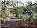
North Downs Way by South Lodge, Marden Park
Here it crosses the drive into the park.
Image: © Robin Webster
Taken: 3 Feb 2011
0.00 miles
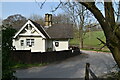
3
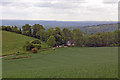
South Lodge
Looking towards South Lodge (see Image), with the start of Horse Chestnut Avenue, leading through Marden Park to Woldingham School, to its left. In the background is the low lying land of the upper Eden valley.
Image: © Ian Capper
Taken: 19 Jun 2010
0.01 miles
4
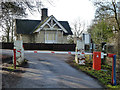
South Lodge and drive barrier, Marden Park
Looking out of the park.
Image: © Robin Webster
Taken: 3 Feb 2011
0.01 miles
5
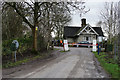
Marden Park, Woldingham
Looking towards the south lodge, which sits on the North Downs. The cyclists were awaiting a colleague, who was forced to walk up the shallow gradient.
Image: © Peter Trimming
Taken: 28 Nov 2015
0.01 miles
6
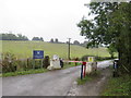
Gateway near Godstone
A gateway on a private road on the North Downs, near Godstone. Although the road is private, it is a public right of way as a bridleway, and also forms part of the route of National Cycle Network route 21.
Image: © Malc McDonald
Taken: 12 Oct 2019
0.01 miles
7
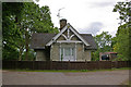
South Lodge
At the southern entrance to Marden Park, now Woldingham School, linked to the school itself by Horse Chestnut Avenue. Marden Park was created as a luxury country estate in the 1670s by Sir Robert Clayton, a wealthy banker and Lord Mayor of London from 1679-80, who bought the valley in 1671.
Image: © Ian Capper
Taken: 19 Jun 2010
0.01 miles
8
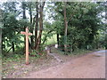
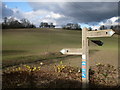
North Downs Way near Godstone
The wooden signpost indicates the route of a footpath. The path forms part of two long distance footpaths, the North Downs Way and Pilgrim's Way.
Image: © Malc McDonald
Taken: 12 Oct 2019
0.01 miles
10

Gate to Woldingham School
Things have been smartened up since Image and Image were taken. The road is used by Godstone bridleway 116b which soon becomes Woldingham bridleway 30 when it crosses the parish boundary.
Image: © Derek Harper
Taken: 25 Apr 2022
0.01 miles