IMAGES TAKEN NEAR TO
Bramble Close, OXTED, RH8 0RY
Introduction
This page details the photographs taken nearby to Bramble Close, RH8 0RY by members of the Geograph project.
The Geograph project started in 2005 with the aim of publishing, organising and preserving representative images for every square kilometre of Great Britain, Ireland and the Isle of Man.

There are currently over 7.5m images from over14,400 individuals and you can help contribute to the project by visiting https://www.geograph.org.uk
Image Map (Loading...)


Getting Data...Please wait
Leaflet Map data © OpenStreetMap
Images are licensed for reuse under creativecommons.org/licenses/by-sa/2.0
Notes
- Clicking on the map will re-center to the selected point.
- The higher the marker number, the further away the image location is from the centre of the postcode.
Image Listing (10 Images Found)
Images are licensed for reuse under creativecommons.org/licenses/by-sa/2.0
Image
Details
Distance
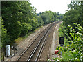
1
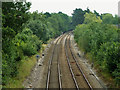
The Uckfield Line heads south
Ahead is just visible the bridge over Red Lane. The view is from the bridge on Holland Lane. The whistle board is because there is a footpath level crossing a bit further round the bend.
Image: © Robin Webster
Taken: 29 Jul 2011
0.05 miles
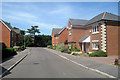
2
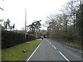
Red Lane, Holland
Looking towards the railway bridge
Image: © David Howard
Taken: 25 Jan 2015
0.09 miles
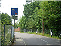
3
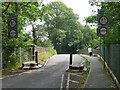
Width and weight restriction, Holland Lane
Protecting the weak railway bridge SCU1 525 over the Uckfield branch.
Image: © Robin Webster
Taken: 29 Jul 2011
0.10 miles
4
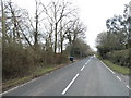
Red Lane, Holland
This is still Geograph UK, Holland is also in Surrey.
Image: © David Howard
Taken: 25 Jan 2015
0.12 miles
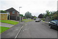
5
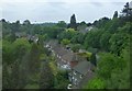
Residential area with plenty of trees
Near Hurst Green. Viewed from train heading to Victoria.
Image: © Russel Wills
Taken: 17 May 2014
0.15 miles
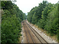
6
Railway towards East Grinstead
Looking from Holland Lane bridge.
Image: © Robin Webster
Taken: 29 Jul 2011
0.15 miles
8
Uckfield branch looking towards Hurst Green
It joins the East Grinstead line just round the bend,
Image: © Robin Webster
Taken: 29 Jul 2011
0.17 miles
9
Roseacre, Hurst Green
A residential road near the southern edge of Hurst Green. I am told the Greenwich Meridian passes just to the west, though that isn't compatible with the British National Grid.
Image: © Bill Boaden
Taken: 26 Jun 2012
0.20 miles
10
Holland Lane towards railway bridge HGG1 844
Over the line to East Grinstead.
Image: © Robin Webster
Taken: 29 Jul 2011
0.21 miles