IMAGES TAKEN NEAR TO
Pains Hill, OXTED, RH8 0RB
Introduction
This page details the photographs taken nearby to Pains Hill, RH8 0RB by members of the Geograph project.
The Geograph project started in 2005 with the aim of publishing, organising and preserving representative images for every square kilometre of Great Britain, Ireland and the Isle of Man.

There are currently over 7.5m images from over14,400 individuals and you can help contribute to the project by visiting https://www.geograph.org.uk
Image Map
Images are licensed for reuse under creativecommons.org/licenses/by-sa/2.0
Notes
- Clicking on the map will re-center to the selected point.
- The higher the marker number, the further away the image location is from the centre of the postcode.
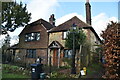
Image Listing (43 Images Found)
Images are licensed for reuse under creativecommons.org/licenses/by-sa/2.0
Image
Details
Distance
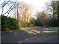
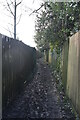
9
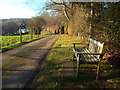
Pains Hill, near Limpsfield
This driveway is private for motor vehicles, but is a public right of way for pedestrians.
Image: © Malc McDonald
Taken: 21 Jan 2017
0.12 miles
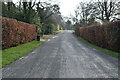
10
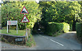
Pains Hill - Steep Hill 14%
Pains Hill, Oxted. 14% steep hill down sign.
Image: © Adam Morse
Taken: 5 Jul 2009
0.12 miles