IMAGES TAKEN NEAR TO
Chichele Road, OXTED, RH8 0AE
Introduction
This page details the photographs taken nearby to Chichele Road, RH8 0AE by members of the Geograph project.
The Geograph project started in 2005 with the aim of publishing, organising and preserving representative images for every square kilometre of Great Britain, Ireland and the Isle of Man.

There are currently over 7.5m images from over14,400 individuals and you can help contribute to the project by visiting https://www.geograph.org.uk
Image Map
Images are licensed for reuse under creativecommons.org/licenses/by-sa/2.0
Notes
- Clicking on the map will re-center to the selected point.
- The higher the marker number, the further away the image location is from the centre of the postcode.
Image Listing (108 Images Found)
Images are licensed for reuse under creativecommons.org/licenses/by-sa/2.0
Image
Details
Distance
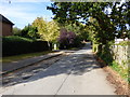
1
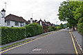
Chicele Road
Early 20th Century development (the road first appears on the 1910 6 inch map, partially built).
Image: © Ian Capper
Taken: 3 Jul 2013
0.03 miles
2
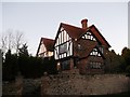
12 Chichele Road, Oxted
House in front of All-Saints Church.
Possibly a rectory in the past?
Image: © David Anstiss
Taken: 27 Nov 2011
0.04 miles
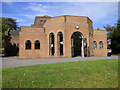
3
Catholic Church of All Saints, Oxted (2)
Large Grade II listed church with an access lane to Chichele Road.
See http://www.britishlistedbuildings.co.uk/en-471712-church-of-all-saints-oxted for more details about the church.
Image: © David Anstiss
Taken: 27 Nov 2011
0.06 miles
4
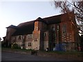
Catholic Church of All Saints, Oxted
Large Grade II listed church with an access lane to Chichele Road.
See http://www.britishlistedbuildings.co.uk/en-471712-church-of-all-saints-oxted for more details about the church.
Image: © David Anstiss
Taken: 27 Nov 2011
0.07 miles
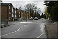
5
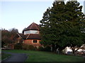
Oxted: Bluehouse Lane
Looking north.
Image: © Dr Neil Clifton
Taken: 7 Oct 2014
0.10 miles
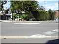
7
Junction of Silkham Road and Chichele Road
In the background is St Marys Junior School.
Image: © Ian Capper
Taken: 3 Jul 2013
0.10 miles
9
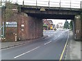
Railway bridge at northern end of Oxted station
The church is visible through the arch. Remains of recent snowfall can be seen on the far pavements and church roof.
Image: © David Martin
Taken: 25 Jan 2013
0.12 miles
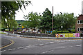
10
Oxted United Reformed Church
Clearly an active and well-used church - doors wide open and welcoming even on Monday.
Image: © Dr Neil Clifton
Taken: 7 Oct 2014
0.12 miles