IMAGES TAKEN NEAR TO
East Park Lane, LINGFIELD, RH7 6HS
Introduction
This page details the photographs taken nearby to East Park Lane, RH7 6HS by members of the Geograph project.
The Geograph project started in 2005 with the aim of publishing, organising and preserving representative images for every square kilometre of Great Britain, Ireland and the Isle of Man.

There are currently over 7.5m images from over14,400 individuals and you can help contribute to the project by visiting https://www.geograph.org.uk
Image Map
Images are licensed for reuse under creativecommons.org/licenses/by-sa/2.0
Notes
- Clicking on the map will re-center to the selected point.
- The higher the marker number, the further away the image location is from the centre of the postcode.
Image Listing (12 Images Found)
Images are licensed for reuse under creativecommons.org/licenses/by-sa/2.0
Image
Details
Distance
1
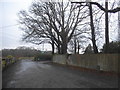
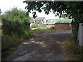
The entrance to Michael's Business Centre
See similar photo here. This used to be East Park Farm.
Image: © David Howard
Taken: 15 Jan 2017
0.09 miles
2
Entrance - Michael's Business Centre
The sign points left, through the closed gate. There is also another entrance to the right - perhaps where Michael lives?
Image: © Robin Webster
Taken: 30 Jan 2010
0.09 miles
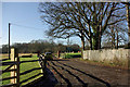
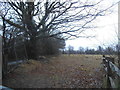
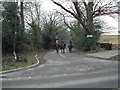
4
Kingswood Farm
As seen from East Park Lane.
Image: © Hugh Craddock
Taken: 28 Dec 2007
0.11 miles
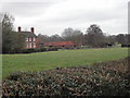
6
Farm buildings, East Park Farm, Surrey
This farm is reached down a small lane off the north side of the B2028. Incidentally, geographers working in this gridsquare should be warned not to go onto the notorious Plantation Estate, where strangers, especially those with cameras, are very far from welcome.
Image: © Dr Neil Clifton
Taken: 30 Jul 2006
0.12 miles
8
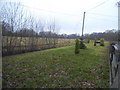
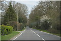
Row of trees by East Park Road, Newchapel
Image: © David Howard
Taken: 15 Jan 2017
0.14 miles
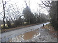
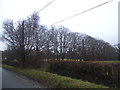
10
Stubpond Lane
A minor road leading south to Felbridge off West Park Road (B2028), but (in part) not maintained as fit for motor vehicles (although perfectly passable if you don't mind a few potholes). Eventually emerges at Hedgecourt Lake Image
Image: © Hugh Craddock
Taken: 28 Dec 2007
0.18 miles