IMAGES TAKEN NEAR TO
Blacksmith Road, HORLEY, RH6 9FF
Introduction
This page details the photographs taken nearby to Blacksmith Road, RH6 9FF by members of the Geograph project.
The Geograph project started in 2005 with the aim of publishing, organising and preserving representative images for every square kilometre of Great Britain, Ireland and the Isle of Man.

There are currently over 7.5m images from over14,400 individuals and you can help contribute to the project by visiting https://www.geograph.org.uk
Image Map
Images are licensed for reuse under creativecommons.org/licenses/by-sa/2.0
Notes
- Clicking on the map will re-center to the selected point.
- The higher the marker number, the further away the image location is from the centre of the postcode.
Image Listing (19 Images Found)
Images are licensed for reuse under creativecommons.org/licenses/by-sa/2.0
Image
Details
Distance
1
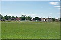
Housing advancing over green fields, Horley 2010
The green fields were soon built over.
Image: © Robin Webster
Taken: 18 Jul 2010
0.05 miles
4
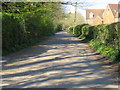
Horley: Lake Lane
Looking towards Greatlake Farm.
Image: © Nigel Cox
Taken: 18 Aug 2006
0.11 miles
5
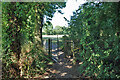
Gate on footpath 575 Horley, 2010
This was before the fields to either side were built over for housing.
Image: © Robin Webster
Taken: 18 Jul 2010
0.12 miles
6
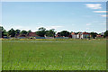
Greenfield development north of Horley
This is a major development on green fields, probably once looking similar to that in the foreground!
Image: © Robin Webster
Taken: 18 Jul 2010
0.12 miles
7
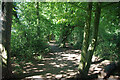
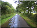
Footpath 575 Horley heads north, 2010
This was before the fields to either side were built over for housing.
Image: © Robin Webster
Taken: 18 Jul 2010
0.12 miles
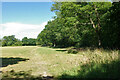
8
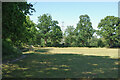
Footpath 575 Horley and field to east, 2010
The field is now built over with housing.
Image: © Robin Webster
Taken: 18 Jul 2010
0.14 miles
9
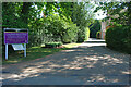
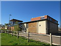
Entrance, Langshott Manor Hotel, 2010
And Mulberry Restaurant.
Image: © Robin Webster
Taken: 18 Jul 2010
0.14 miles
10
Field edge east of footpath 575 Horley, 2010
The field is now built over with housing.
Image: © Robin Webster
Taken: 18 Jul 2010
0.14 miles