IMAGES TAKEN NEAR TO
Haroldslea Drive, HORLEY, RH6 9DT
Introduction
This page details the photographs taken nearby to Haroldslea Drive, RH6 9DT by members of the Geograph project.
The Geograph project started in 2005 with the aim of publishing, organising and preserving representative images for every square kilometre of Great Britain, Ireland and the Isle of Man.

There are currently over 7.5m images from over14,400 individuals and you can help contribute to the project by visiting https://www.geograph.org.uk
Image Map
Images are licensed for reuse under creativecommons.org/licenses/by-sa/2.0
Notes
- Clicking on the map will re-center to the selected point.
- The higher the marker number, the further away the image location is from the centre of the postcode.
Image Listing (65 Images Found)
Images are licensed for reuse under creativecommons.org/licenses/by-sa/2.0
Image
Details
Distance
1
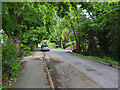
Haroldslea Drive, Horley
Looking east.
Image: © Robin Webster
Taken: 21 May 2022
0.05 miles
2
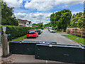
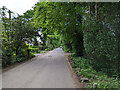
Castle Drive, Horley
Blocked off from Haroldslea Drive, the sign on the left starts 'This is a private road for access only'. Vehicle access is from the other end on Balcombe Road.
Image: © Robin Webster
Taken: 21 May 2022
0.07 miles
3
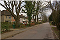
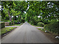
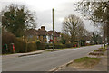
Haroldsea Drive
Largely developed in the 1930s, the name of this road is derived from the 19th century version of the Saxon name for the area, Herewoldesle.
Image: © Ian Capper
Taken: 9 Mar 2010
0.08 miles
4
Haroldslea Drive, Horley
Looking east.
Image: © Robin Webster
Taken: 21 May 2022
0.08 miles
5
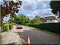
Haroldslea Drive, Horley
Looking west towards Balcombe Road.
Image: © Robin Webster
Taken: 21 May 2022
0.10 miles
7
Haroldslea Drive, Horley
Looking west towards Balcombe Road.
Image: © Robin Webster
Taken: 21 May 2022
0.12 miles
8
Balcombe Road
The Balcombe Road dates from 1809 when a turnpike was built to Cuckfield. This section was largely developed in the 1920s/30s.
Image: © Ian Capper
Taken: 9 Mar 2010
0.12 miles
9
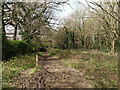
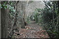
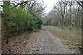
Footpath 381, Horley
A long straight path, possibly along the boundary of the long gone Thunderfield Common, which would have been to the right.
Image: © Robin Webster
Taken: 5 Apr 2022
0.12 miles