
IMAGES TAKEN NEAR TO
Crescent Court, The Crescent, HORLEY, RH6 7NR
Introduction
This page details the photographs taken nearby to Crescent Court, The Crescent, RH6 7NR by members of the Geograph project.
The Geograph project started in 2005 with the aim of publishing, organising and preserving representative images for every square kilometre of Great Britain, Ireland and the Isle of Man.

There are currently over 7.5m images from over14,400 individuals and you can help contribute to the project by visiting https://www.geograph.org.uk
Image Map
Images are licensed for reuse under creativecommons.org/licenses/by-sa/2.0
Notes
- Clicking on the map will re-center to the selected point.
- The higher the marker number, the further away the image location is from the centre of the postcode.
Image Listing (46 Images Found)
Images are licensed for reuse under creativecommons.org/licenses/by-sa/2.0
Image
Details
Distance
1
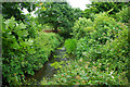
Gatwick Stream, Riverside Garden Park, Horley
Looking upstream.
Image: © Robin Webster
Taken: 7 Jul 2010
0.09 miles
2
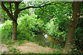
Gatwick Stream, Riverside Garden Park, Horley
Looking downstream.
Image: © Robin Webster
Taken: 7 Jul 2010
0.11 miles
3
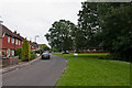
Riverside
Housing alongside the Gatwick Stream, some of it built for the local council in the late 1950s/early 1960s.
Image: © Ian Capper
Taken: 5 Jul 2012
0.13 miles
4
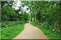
Path, Riverside Garden Park, Horley
Towards Gatwick South Terminal, a cycleway.
Image: © Robin Webster
Taken: 7 Jul 2010
0.13 miles
5
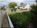
Looking into Riverside from the bridge over Gatwick Stream
Behind the camera is the parking area in Riverside Garden Park.
See also http://www.geograph.org.uk/photo/3314351. This is in Surrey.
Image: © Shazz
Taken: 2 Jun 2016
0.13 miles
6
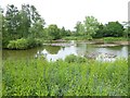
The lake in Riverside Garden Park
The lake is in Surrey.
Image: © Shazz
Taken: 2 Jun 2016
0.13 miles
7
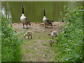
Gatwick geese and goslings
There are also a moorhen with chick in the picture. The lake is in Riverside Garden Park in Surrey.
Image: © Shazz
Taken: 2 Jun 2016
0.13 miles
8
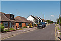
The Crescent
Originally laid out in the 1930s but largely developed post World War II.
Image: © Ian Capper
Taken: 27 May 2012
0.13 miles
9
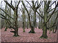
Horley: Riverside Garden Park
As an antidote to all those other photographs of the airport and its infrastructure in this grid square, here's a photo of a wooded area of Riverside Garden Park, the river in question being Gatwick Stream. This area used to form part of Horley Common, and the park is managed by the local authority, Reigate and Banstead Borough Council. (Incidentally one has to question the wisdom of how these large borough councils are named. Just what affinity do the denizens of Horley (or Redhill or Tadworth for that matter) feel towards Reigate or Banstead?)
Image: © Nigel Cox
Taken: 19 Jan 2009
0.14 miles
10
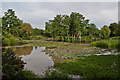
Riverside Garden Park
The lake in Riverside Garden Park, an area of greenery sandwiched between Horley and the A23 into Gatwick Airport, alongside the Gatwick Stream.
Image: © Ian Capper
Taken: 5 Jul 2012
0.14 miles