
IMAGES TAKEN NEAR TO
Oakwood Road, HORLEY, RH6 7BY
Introduction
This page details the photographs taken nearby to Oakwood Road, RH6 7BY by members of the Geograph project.
The Geograph project started in 2005 with the aim of publishing, organising and preserving representative images for every square kilometre of Great Britain, Ireland and the Isle of Man.

There are currently over 7.5m images from over14,400 individuals and you can help contribute to the project by visiting https://www.geograph.org.uk
Image Map
Images are licensed for reuse under creativecommons.org/licenses/by-sa/2.0
Notes
- Clicking on the map will re-center to the selected point.
- The higher the marker number, the further away the image location is from the centre of the postcode.
Image Listing (41 Images Found)
Images are licensed for reuse under creativecommons.org/licenses/by-sa/2.0
Image
Details
Distance
1
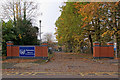
Yattendon School
Entrance to Yattendon School, a mixed school for 7 - 11 year olds off Oakwood Road.
Image: © Ian Capper
Taken: 7 Nov 2010
0.08 miles
2
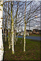
Horley One-way
A view of the Balcombe Road from the south side of the one-way system around the Shell Petrol Station
Image: © Kurseong Carl
Taken: 22 Jan 2011
0.11 miles
3
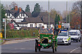
No speeding
A 1902 Gladiator driving along Brighton Road, Horley, just south of the Chequers Roundabout, taking part in the 2010 London-Brighton Veteran Car Run. In the background is the Chequers Hotel. The police car trailing the car was presumably not looking out for a speeding offence.
The London-Brighton Veteran Car Run is an annual event, taking place on the first Sunday of November, in commemoration of the Emancipation Run of 14 November 1896 which celebrated the raising of the speed limit for 'light locomotives' from 4 mph to 14 mph and removed the requirement for vehicles to be escorted by a man on foot. The next Run was in 1927, after which it was annual to 1938, with a further run in 1946, and then annual from 1948 onwards - the 2010 Run was the 77th event.
The orange sign in the background was a route marker for the 2010 Brighton-London Future Car Challenge that had taken place the previous day, in the reverse direction to the Veteran Car Run, as a showcase for low energy vehicles.
Image: © Ian Capper
Taken: 7 Nov 2010
0.11 miles
4
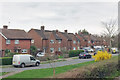
Houses on Chequers Drive, Horley
A road here parallel with the A23.
Image: © Robin Webster
Taken: 23 Mar 2019
0.13 miles
5
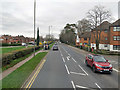
A23 Brighton Road, Horley
The bus stop ahead is Lumley Road, for routes 26, 400 and 460 towards Redhill. A view from a 400 bus.
Image: © Robin Webster
Taken: 23 Mar 2019
0.13 miles
6
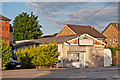
Drivenet Garage
A small garage on the Chequers Roundabout on a site with motor engineering links back to the start of the 20th century, fittingly given that this is on the route of the annual London-Brighton veteran car run.
Image: © Ian Capper
Taken: 13 Jun 2012
0.14 miles
8
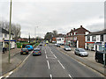
A23 Brighton Road, Horley
Looking north.
Image: © Robin Webster
Taken: 23 Mar 2019
0.15 miles
9
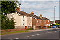
Balcombe Road
Victorian cottages on the Balcombe Road, here forming part of the Chequers Roundabout.
Image: © Ian Capper
Taken: 13 Jun 2012
0.15 miles
10
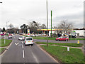
Roundabout on A23, Horley
Where the B2036 splits off (to the right) to give an alternative route towards Brighton. This is looking towards London. The Shell station is in the middle of the roundabout.
Image: © Robin Webster
Taken: 23 Mar 2019
0.15 miles