IMAGES TAKEN NEAR TO
Guildford Road, DORKING, RH5 6QB
Introduction
This page details the photographs taken nearby to Guildford Road, RH5 6QB by members of the Geograph project.
The Geograph project started in 2005 with the aim of publishing, organising and preserving representative images for every square kilometre of Great Britain, Ireland and the Isle of Man.

There are currently over 7.5m images from over14,400 individuals and you can help contribute to the project by visiting https://www.geograph.org.uk
Image Map (Loading...)


Getting Data...Please wait
Leaflet Map data © OpenStreetMap
Images are licensed for reuse under creativecommons.org/licenses/by-sa/2.0
Notes
- Clicking on the map will re-center to the selected point.
- The higher the marker number, the further away the image location is from the centre of the postcode.
Image Listing (39 Images Found)
Images are licensed for reuse under creativecommons.org/licenses/by-sa/2.0
Image
Details
Distance
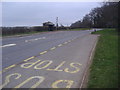
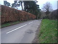
1
A25 and North Downs at junction of Hollow Lane
Image: © David Howard
Taken: 14 Mar 2011
0.02 miles
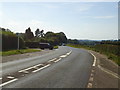
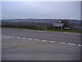
5
Hollow Lane at the junction of Guildford Road
Image: © David Howard
Taken: 7 Feb 2016
0.03 miles
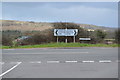
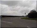
6
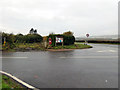
Wotton: Junction of Hollow Lane with Guildford Road (A25)
Hollow Lane comes in from the left. It provides useful access to the Surrey Hills AONB.
Image: © Dr Neil Clifton
Taken: 16 Nov 2014
0.03 miles
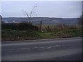
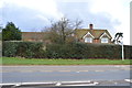
7
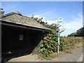
Manor Farm bus stop, Guildford Road, near Wotton
Image: © Stacey Harris
Taken: 2 Sep 2011
0.03 miles