IMAGES TAKEN NEAR TO
Abinger Common, DORKING, RH5 6LW
Introduction
This page details the photographs taken nearby to RH5 6LW by members of the Geograph project.
The Geograph project started in 2005 with the aim of publishing, organising and preserving representative images for every square kilometre of Great Britain, Ireland and the Isle of Man.

There are currently over 7.5m images from over14,400 individuals and you can help contribute to the project by visiting https://www.geograph.org.uk
Image Map
Images are licensed for reuse under creativecommons.org/licenses/by-sa/2.0
Notes
- Clicking on the map will re-center to the selected point.
- The higher the marker number, the further away the image location is from the centre of the postcode.
Image Listing (16 Images Found)
Images are licensed for reuse under creativecommons.org/licenses/by-sa/2.0
Image
Details
Distance
1
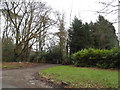
The entrance to Park House Farm, Leith Hill
Image: © David Howard
Taken: 7 Feb 2016
0.09 miles
2
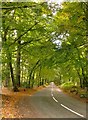
Road through beech woodland
View southward along Leith Hill Road. The 205m contour runs nearby - we are quite high up by the standards of south-east England.
Behind the camera the woodland is more mixed, with a proportion of conifers.
Image: © Stefan Czapski
Taken: 4 Oct 2013
0.12 miles
3
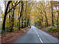
Leith Hill Road in autumn
Looking south. The solitary cyclist was not the only visitor to the Surrey Hills AONB on this pleasant November day.
Image: © Dr Neil Clifton
Taken: 16 Nov 2014
0.12 miles
5
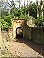
Tunnel for footpath under the drive leading to 'Parkhurst'
It's not often you come across such ornate tunnels/bridges for a footpath.
Image: © Frazer Crump
Taken: 21 Mar 2010
0.15 miles
6
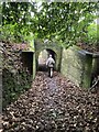
Carriage-drive bridge over footpath 27
Footpath Abinger 27 passes under the carriage drive to Parkhurst through an ornamental bridge. For the other side, see Image The bridge can be seen on late C19 Ordnance Survey plans.
Image: © Hugh Craddock
Taken: 31 Dec 2024
0.16 miles
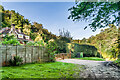
8
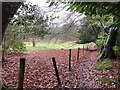
Footpath 27 at Parkhurst Wood
Footpath Abinger 27 provides a short-cut between Pasture Wood Road and Leith Hill Road.
Image: © Hugh Craddock
Taken: 31 Dec 2024
0.21 miles
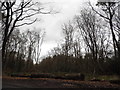
10
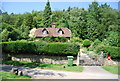
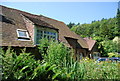
Woodlands
House on Abinger Common Road.
Image: © Ian Capper
Taken: 11 Oct 2021
0.22 miles