IMAGES TAKEN NEAR TO
Abinger Lane, DORKING, RH5 6HZ
Introduction
This page details the photographs taken nearby to Abinger Lane, RH5 6HZ by members of the Geograph project.
The Geograph project started in 2005 with the aim of publishing, organising and preserving representative images for every square kilometre of Great Britain, Ireland and the Isle of Man.

There are currently over 7.5m images from over14,400 individuals and you can help contribute to the project by visiting https://www.geograph.org.uk
Image Map
Images are licensed for reuse under creativecommons.org/licenses/by-sa/2.0
Notes
- Clicking on the map will re-center to the selected point.
- The higher the marker number, the further away the image location is from the centre of the postcode.
Image Listing (122 Images Found)
Images are licensed for reuse under creativecommons.org/licenses/by-sa/2.0
Image
Details
Distance
3
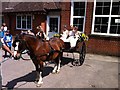
Abinger Medieval Fair: Procession about to start from the Primary School
To be followed by the Crowning of the May Queen. http://www.abingerfair.com/home
Image: © Jonathan Hutchins
Taken: 11 Jun 2011
0.05 miles
5
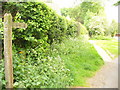
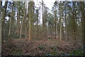
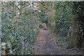
Leaving Abinger Bottom
The start of the footpath from Abinger Bottom, through High Copse, to Wotton.
Image: © Colin Smith
Taken: 24 May 2008
0.05 miles
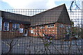
8
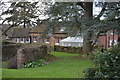
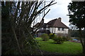
Ellixwood cottages
looking south-east
Image: © Andrew Longton
Taken: 28 Sep 2005
0.07 miles