
IMAGES TAKEN NEAR TO
Anstie Lane, DORKING, RH5 6HA
Introduction
This page details the photographs taken nearby to Anstie Lane, RH5 6HA by members of the Geograph project.
The Geograph project started in 2005 with the aim of publishing, organising and preserving representative images for every square kilometre of Great Britain, Ireland and the Isle of Man.

There are currently over 7.5m images from over14,400 individuals and you can help contribute to the project by visiting https://www.geograph.org.uk
Image Map
Images are licensed for reuse under creativecommons.org/licenses/by-sa/2.0
Notes
- Clicking on the map will re-center to the selected point.
- The higher the marker number, the further away the image location is from the centre of the postcode.
Image Listing (31 Images Found)
Images are licensed for reuse under creativecommons.org/licenses/by-sa/2.0
Image
Details
Distance
2
Anstie Lane, Coldharbour
A quiet rural lane in the Surrey Hills, with several large houses out of sight.
Image: © Colin Smith
Taken: 20 Feb 2011
0.03 miles
3
Anstie Lane, Coldharbour, Surrey
Around the bend and under the trees; the climb gets serious from this point onwards.
Image: © Peter Trimming
Taken: 16 Jul 2009
0.04 miles
5
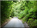
Anstie Lane, Coldharbour, Surrey
Dense foliage, on either side of the lane, gives the impression that you are travelling through a corridor.
Image: © Peter Trimming
Taken: 16 Jul 2009
0.07 miles
6
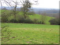
Fields beside Anstie Lane looking south
This is a lovely area with rolling hills and distant views
Image: © Pip Rolls
Taken: 17 Jan 2006
0.09 miles
8
Sunken Anstie Lane
Wooded stretch of Anstie Lane, passing Spring Copse, Coldharbour.
Image: © Colin Smith
Taken: 20 Feb 2011
0.09 miles
9
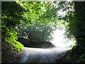
Anstie Lane, Coldharbour, Surrey
Out of the tunnel of trees, and briefly into daylight; before the road turns sharply to the left, into another tunnel. Just around the corner, the gradient steepens to approximately 15%.
In April 2003, I was testing out my new triple chainset bike on this hill, in preparation for a trip to the Lake District. Going around this corner, I was mildly irritated when my chain fell off for no obvious reason. That was nothing compared to how I felt, a couple of weeks later, when my chain fell off several times on the 30% gradient ascent of Hardknott Pass! Very frustrating to have my club colleagues overtake me, and ride off into the distance. The makers identified and sorted the problem for me, and my solo ascent of Hardknott Pass, three months later, was trouble-free.
Image: © Peter Trimming
Taken: 16 Jul 2009
0.09 miles
10
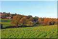
Near Antsie Lane, Holmwood
Isolated houses, near Holmwood in the Surrey commuter belt.
Image: © Wayland Smith
Taken: 15 Nov 2014
0.09 miles