IMAGES TAKEN NEAR TO
Standon Lane, DORKING, RH5 5QR
Introduction
This page details the photographs taken nearby to Standon Lane, RH5 5QR by members of the Geograph project.
The Geograph project started in 2005 with the aim of publishing, organising and preserving representative images for every square kilometre of Great Britain, Ireland and the Isle of Man.

There are currently over 7.5m images from over14,400 individuals and you can help contribute to the project by visiting https://www.geograph.org.uk
Image Map
Images are licensed for reuse under creativecommons.org/licenses/by-sa/2.0
Notes
- Clicking on the map will re-center to the selected point.
- The higher the marker number, the further away the image location is from the centre of the postcode.
Image Listing (13 Images Found)
Images are licensed for reuse under creativecommons.org/licenses/by-sa/2.0
Image
Details
Distance
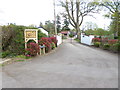
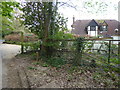
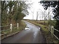
2
The entrance to Standon Stables, Leith Vale
Image: © David Howard
Taken: 7 Feb 2016
0.05 miles
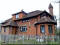
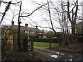
8
Dwellings on New Barn Lane seen from Standon Lane
Image: © Shazz
Taken: 15 Apr 2017
0.21 miles
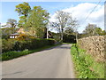
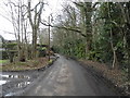
9
Standon Lane, Ockley
Going over the brook
Image: © David Howard
Taken: 7 Feb 2016
0.22 miles
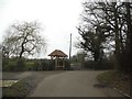
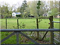
10
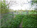
Enclosed bridleway from Standon Lane reaches gate into field
Image: © Shazz
Taken: 15 Apr 2017
0.23 miles