IMAGES TAKEN NEAR TO
Coldharbour Lane, DORKING, RH4 3JH
Introduction
This page details the photographs taken nearby to Coldharbour Lane, RH4 3JH by members of the Geograph project.
The Geograph project started in 2005 with the aim of publishing, organising and preserving representative images for every square kilometre of Great Britain, Ireland and the Isle of Man.

There are currently over 7.5m images from over14,400 individuals and you can help contribute to the project by visiting https://www.geograph.org.uk
Image Map (Loading...)


Getting Data...Please wait
Leaflet Map data © OpenStreetMap
Images are licensed for reuse under creativecommons.org/licenses/by-sa/2.0
Notes
- Clicking on the map will re-center to the selected point.
- The higher the marker number, the further away the image location is from the centre of the postcode.
Image Listing (55 Images Found)
Images are licensed for reuse under creativecommons.org/licenses/by-sa/2.0
Image
Details
Distance
1
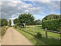
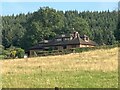
Chadhurst Farm
Looking east along Chadhurst Farm drive with the gardens of Brookmead Cottage on the right.
Image: © P Harris
Taken: 23 Jul 2024
0.02 miles
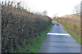
2
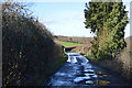
Coldharbour Lane: the turning for Chadhurst Farm
looking south-west
Image: © Andrew Longton
Taken: 28 Sep 2005
0.05 miles
3
Chadhurst Farm
Looking east along Chadhurst Farm drive.
Image: © P Harris
Taken: 23 Jul 2024
0.05 miles
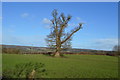
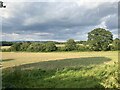
6
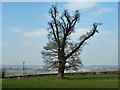
Tree in field
The backdrop is the North Downs.
Image: © Robin Webster
Taken: 4 Mar 2011
0.07 miles
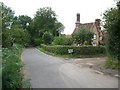
8
Entrance to Chadhurst Farm (Chadhurst Lodge)
Image: © N Chadwick
Taken: 7 Feb 2016
0.08 miles
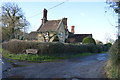
9
Coldharbour Lane
Foxhill on Coldharbour Lane as seen from Chadhurst Farm drive.
Image: © P Harris
Taken: 23 Jul 2024
0.08 miles
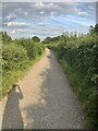
10
Chadhurst Farm
View north east from Chadhurst Farm drive.
Image: © P Harris
Taken: 23 Jul 2024
0.08 miles