IMAGES TAKEN NEAR TO
Reigate Road, DORKING, RH4 1QF
Introduction
This page details the photographs taken nearby to Reigate Road, RH4 1QF by members of the Geograph project.
The Geograph project started in 2005 with the aim of publishing, organising and preserving representative images for every square kilometre of Great Britain, Ireland and the Isle of Man.

There are currently over 7.5m images from over14,400 individuals and you can help contribute to the project by visiting https://www.geograph.org.uk
Image Map
Images are licensed for reuse under creativecommons.org/licenses/by-sa/2.0
Notes
- Clicking on the map will re-center to the selected point.
- The higher the marker number, the further away the image location is from the centre of the postcode.
Image Listing (234 Images Found)
Images are licensed for reuse under creativecommons.org/licenses/by-sa/2.0
Image
Details
Distance
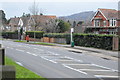
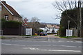
2
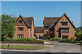
Ashurst Place
Development on Reigate Road, completed in 2004.
Image: © Ian Capper
Taken: 20 May 2018
0.02 miles
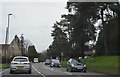
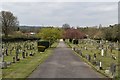
3
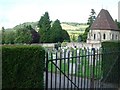
Cemetery beside Reigate Road, Dorking
looking NNE towards Box Hill
Image: © Andrew Longton
Taken: 14 Sep 2005
0.02 miles
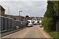
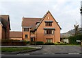
4
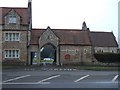
Dorking Cemetery
View of the main entrance to the cemetery taken from Reigate Road, looking North. The Chapel is visible on the right of the picture.
Image: © Martyn Davies
Taken: 9 Jan 2006
0.02 miles