
IMAGES TAKEN NEAR TO
Yew Tree Road, DORKING, RH4 1NE
Introduction
This page details the photographs taken nearby to Yew Tree Road, RH4 1NE by members of the Geograph project.
The Geograph project started in 2005 with the aim of publishing, organising and preserving representative images for every square kilometre of Great Britain, Ireland and the Isle of Man.

There are currently over 7.5m images from over14,400 individuals and you can help contribute to the project by visiting https://www.geograph.org.uk
Image Map
Images are licensed for reuse under creativecommons.org/licenses/by-sa/2.0
Notes
- Clicking on the map will re-center to the selected point.
- The higher the marker number, the further away the image location is from the centre of the postcode.
Image Listing (55 Images Found)
Images are licensed for reuse under creativecommons.org/licenses/by-sa/2.0
Image
Details
Distance
1
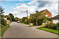
Yew Tree Road
1950s development on part of the Denbies Estate.
Image: © Ian Capper
Taken: 10 Oct 2016
0.02 miles
2
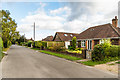
Yew Tree Road
1950s development on part of the Denbies Estate.
Image: © Ian Capper
Taken: 10 Oct 2016
0.04 miles
3
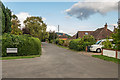
Yew Tree Road
1950s development on part of the Denbies Estate.
Image: © Ian Capper
Taken: 10 Oct 2016
0.04 miles
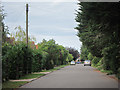
5
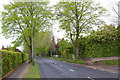
Ashcombe Road
Forming what is effectively a northern bypass to Dorking town centre. On the left are the playing fields of Ashcombe School.
Image: © Ian Capper
Taken: 3 May 2010
0.10 miles
6
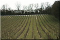
Denbies Vineyard
Traces of the overnight snow, visible in an area of the vineyard which is protected from the winter sun.
Image: © Peter Trimming
Taken: 2 Feb 2019
0.11 miles
7
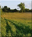
Newly planted vines, Denbies vineyard
The area in the immediate foreground is (for the moment) a patch of wasteland, but beyond that is an area of recent planting - with the vines still in their protective tubes. It's worth observing that the newly planted patch slopes gently northwards. Does that mean the vineyard is doing so well that it's worth expanding into more marginal areas?
Image: © Stefan Czapski
Taken: 10 Jul 2013
0.12 miles
8
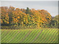
Denbies Vineyard
Autumn colours on trees lining the edge of Denbies Wine Estate, Dorking.
www.denbies.co.uk
Image: © Colin Smith
Taken: 11 Nov 2022
0.12 miles
9
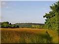
Field of hay, south of Denbies vineyard
One crop which is likely to do well this year - after a cool spring and a July heatwave - is hay. Haymaking depends on dry, settled conditions, so the recent warm weather will have provided a first-rate opportunity. Submitting this image four days after taking it, I suspect that the scene will already have changed - as the field will have been mown in the meantime. In inland areas of south-east England, temperatures have reached 29C on each of the last three days.
Image: © Stefan Czapski
Taken: 10 Jul 2013
0.12 miles
10
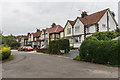
Chalkpit Terrace
1930s housing near the site of the former Dorking Lime Works.
Image: © Ian Capper
Taken: 10 Oct 2015
0.12 miles