IMAGES TAKEN NEAR TO
Old Kiln Lane, BETCHWORTH, RH3 7LP
Introduction
This page details the photographs taken nearby to Old Kiln Lane, RH3 7LP by members of the Geograph project.
The Geograph project started in 2005 with the aim of publishing, organising and preserving representative images for every square kilometre of Great Britain, Ireland and the Isle of Man.

There are currently over 7.5m images from over14,400 individuals and you can help contribute to the project by visiting https://www.geograph.org.uk
Image Map (Loading...)


Getting Data...Please wait
Leaflet Map data © OpenStreetMap
Images are licensed for reuse under creativecommons.org/licenses/by-sa/2.0
Notes
- Clicking on the map will re-center to the selected point.
- The higher the marker number, the further away the image location is from the centre of the postcode.
Image Listing (22 Images Found)
Images are licensed for reuse under creativecommons.org/licenses/by-sa/2.0
Image
Details
Distance
1
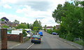
Nutwood Avenue
A small estate to the east of Brockham.
Image: © Jonathan Billinger
Taken: 19 Jun 2008
0.09 miles
2
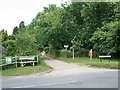
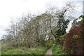
Mill Hill Lane
Mill Hill Lane looking north, at the junction with Kiln Lane. Mill Hill Lane is a public bridleway, Brockham 52.
Image: © Hugh Craddock
Taken: 22 Jun 2008
0.14 miles
3
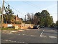
Mill Hill Lane at the junction of Kiln Lane
Image: © David Howard
Taken: 22 Sep 2014
0.14 miles
6
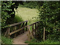
Greensand Way Footbridge
Between Betchworth and Brockham, crossing a drain that leads into the River Mole.
Image: © Colin Smith
Taken: 29 Jun 2012
0.16 miles

8
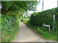
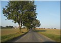
Mill Hill Lane
Forms part of a footpath link between the North Downs Way and the Greensand Way as it leads to a footbridge over the River Mole between Betchworth and Brockham.
Image: © Jonathan Billinger
Taken: 19 Jun 2008
0.17 miles
10
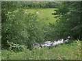
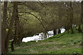
The River Mole, upstream from Brockham
Much of this stretch of the river isn't visible from the right of way. The river swings round a bend, undercutting its right (north) bank, and the steep slope which results is overgrown and well-wooded.
Image: © Stefan Czapski
Taken: 5 Jul 2012
0.19 miles